In 2010, Carris tested Metro-like diagrams to present its offer in three key areas of the city: Marquês, Rossio and Belém. The system was called "Spider Maps" and was developed by a company from Porto.
A subway network is much more noticeable than a map of the bus network. While in the Lisbon Metro there are only four lines, in Carris there are more than a hundred bus and streetcar lines. However, if some of these Carris lines serve neighborhoods or shorter routes, others are authentic lines that cross the cityoften in BUS corridors, which gives them speed and efficiency. Thus, from a given point, a web of Carris connections can develop to destinations that, perhaps, we didn't know were served by public transportation, because the Metro doesn't reach there and Carris maps are overloaded with information.
In September 2010, Carris decided to experiment with the so-called Spider Maps - Simplified maps that were intended to be an alternative to conventional diagrams and that allowed a quick look at the routes and destinations from a given area. The project was launched in three points of high demand and supply for public transportation: Marquês de Pombal, Rossio/Praça da Figueira, and Belém. The development of the Spider Maps was in charge of a company called OPT - Optimization and Transportation Planningwhich was born in the 1990s at the heart of the Faculty of Engineering of the University of Porto.
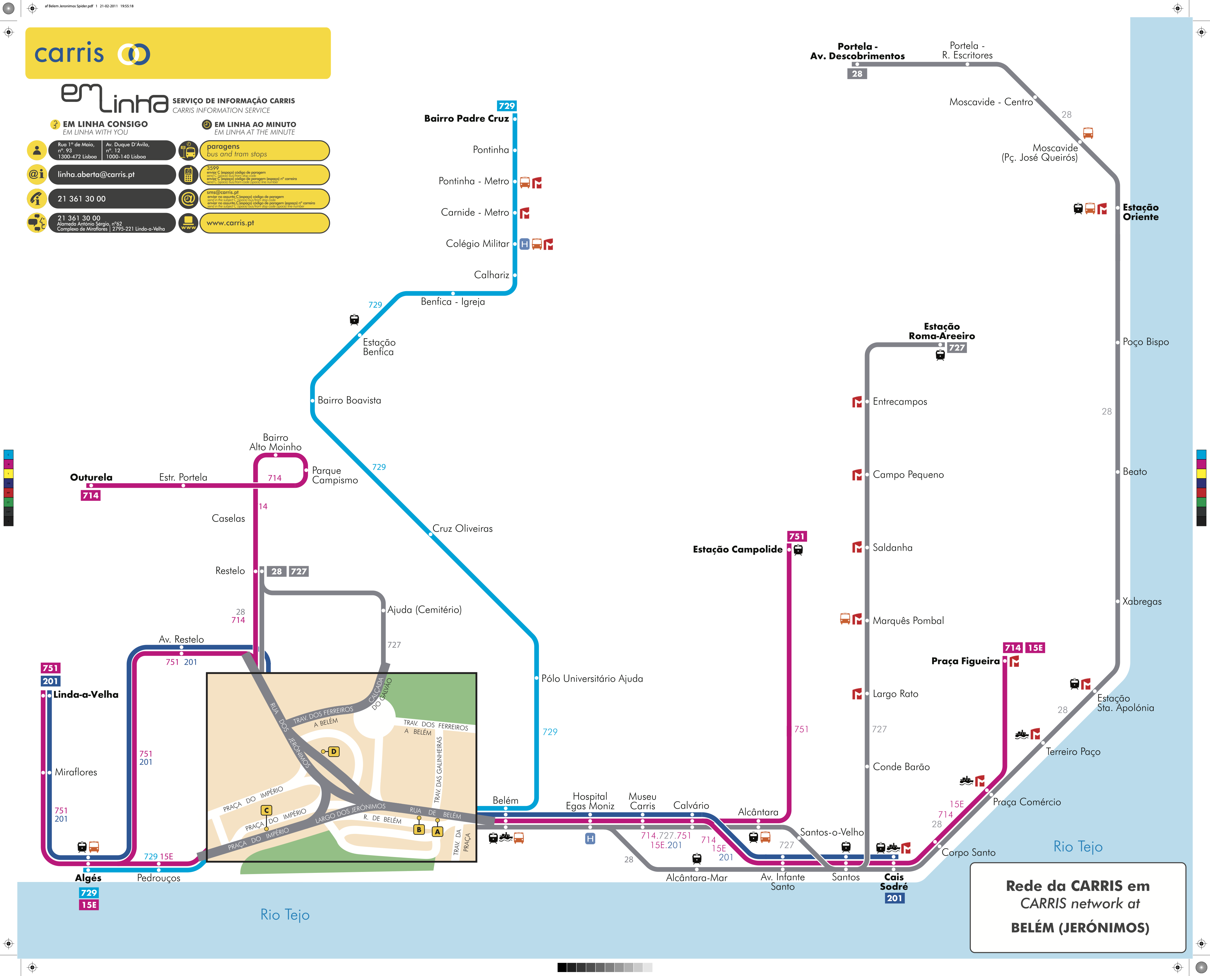
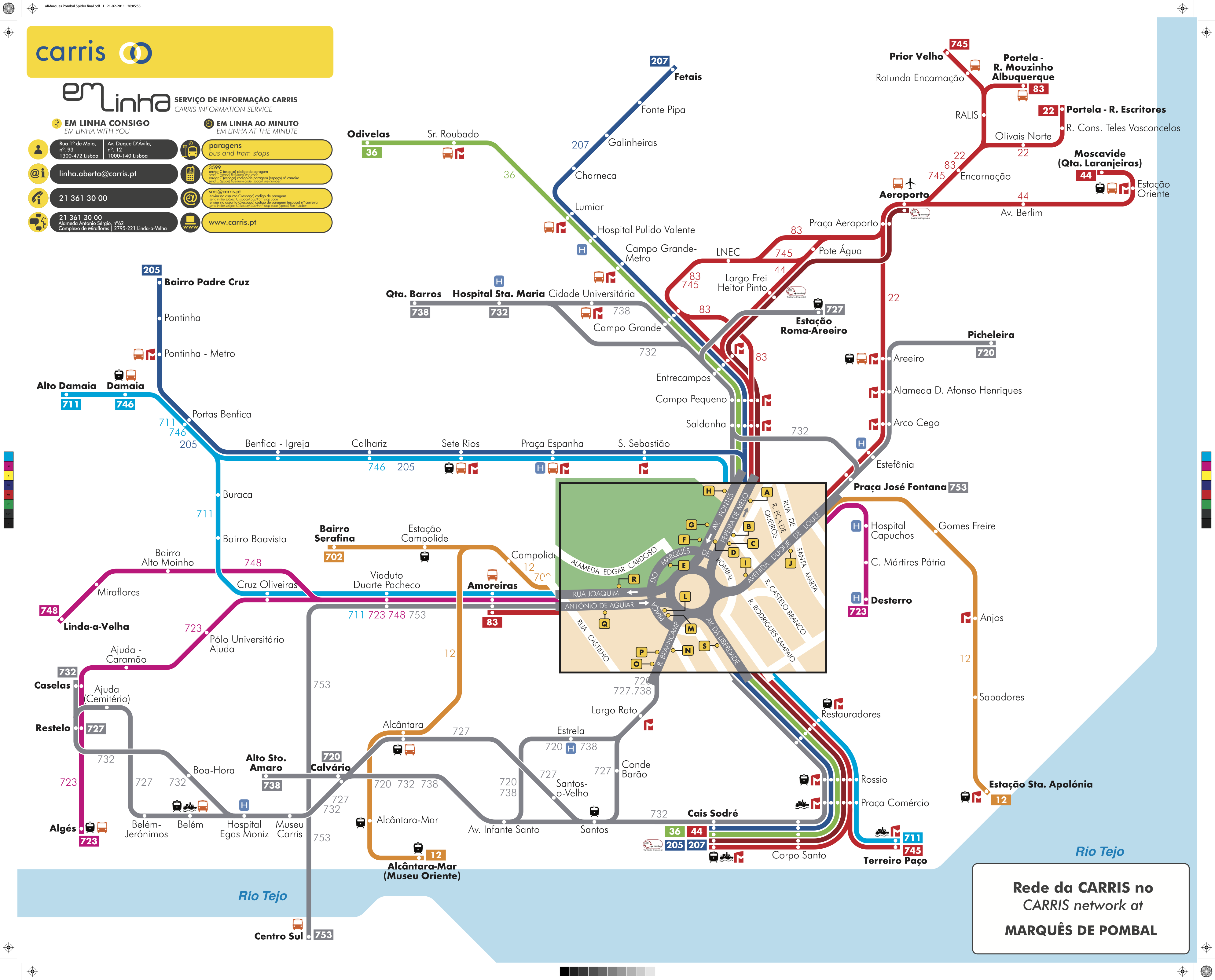
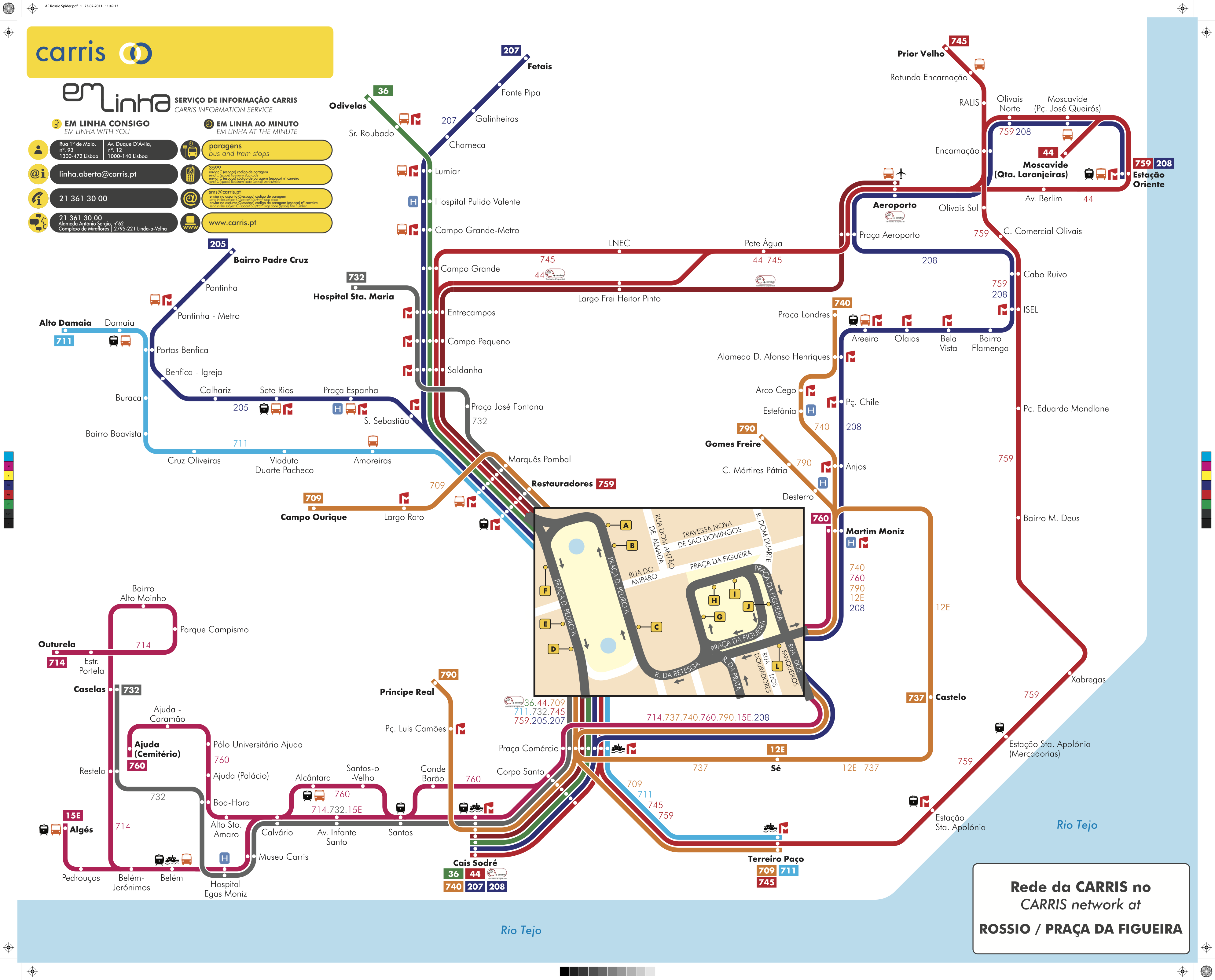
Each Spider Maps released by Carris showed the possible routes and connections from each of the points - Marquês, Rossio and Belém.In the main departures points (Marquês, Rossio and Belém), there are different diagrams, with different colors and with the indication of the intermediate stops, as well as possible connections with other means of transport along the way. At the main departure points (Marquês, Rossio and Belém), the stops were identified with letters A, B, C, D... so that passengers only had to look up their destination on the back of the maps, in an alphabetically sorted list, to know at which stop they would have to wait for the bus. Spider Maps was eventually discontinued.
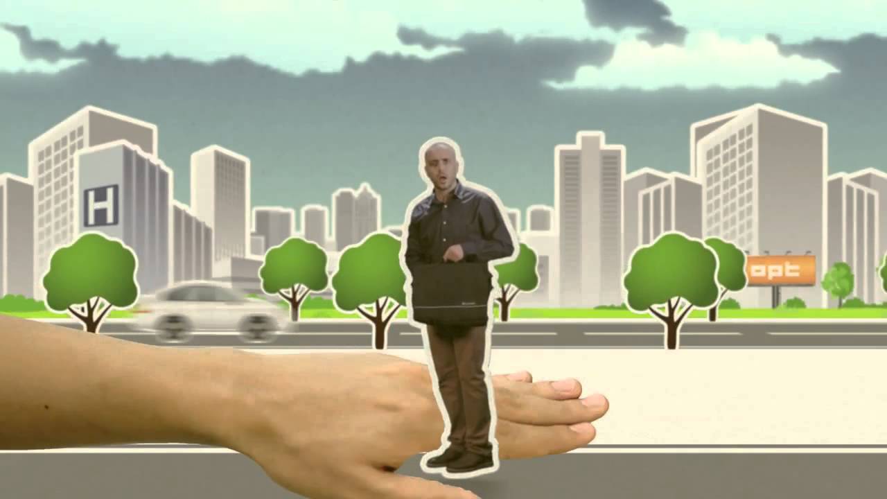
The following video explains the concept of "spider maps":

According to the company OPTthis kind of maps "are developed using a tool that preprocesses the schema based on the network's geographic information, and then improves it from a design and readability point of view without breaking the rules for representing lines and points defined for this type of schema". The Spider Maps "present a most prominent area (the Hub) that occupies the center of the map and, from there, all the bus routes that, in a radial way, head to their final destinations". The goal, OPT says, is to facilitate the perception of the transportation network as a whole, especially in areas where various transportation opportunities are concentrated.
Carris' Spider Maps were recently retrieved in one of the digital community's rubrics Buses from LisbonCarris is a social network that gathers nearly three thousand followers on Facebook, among Carris enthusiasts and people who want to know, in a simple and practical way, all changes to the service of the city's municipal bus operator.