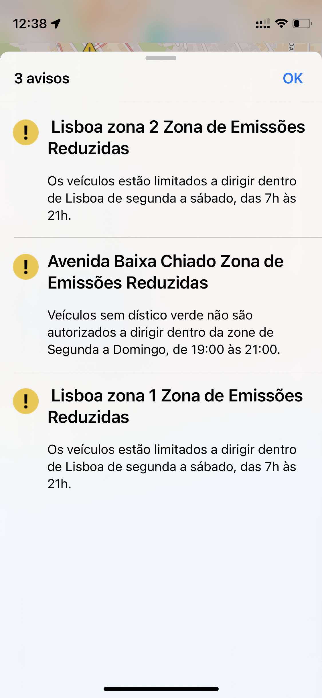
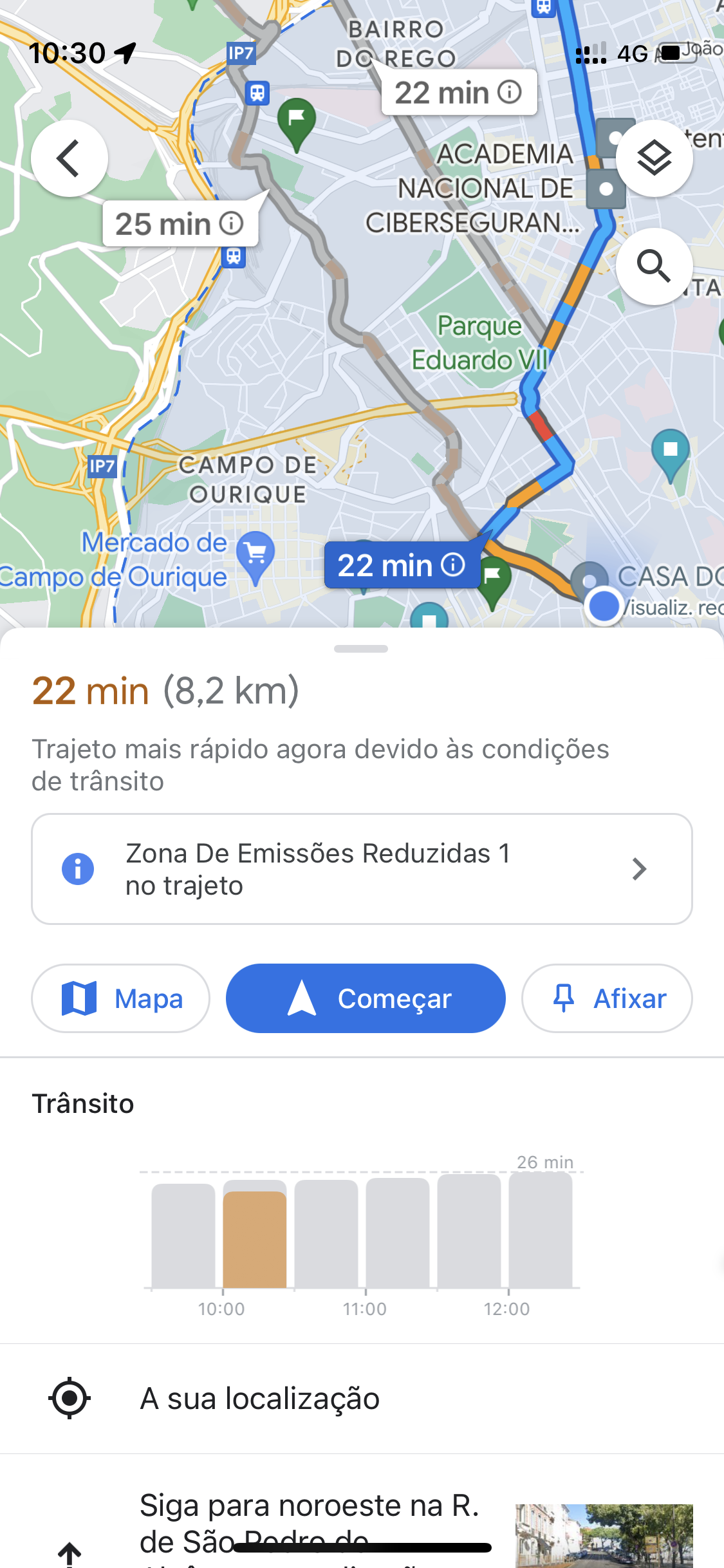
Google Maps now shows the limits of one of Lisbon's ZERs, presenting, however, inaccurate and even wrong information. For example, the app shows information about the restrictions of ZER ABC that does not exist.

The two Reduced Emission Zones in effect in Lisbon are now available on Google Mapsone of the most popular navigation apps. Drivers will now be warned when their route passes through one of the city's restrictive areas. But the information provided by Google is not entirely correct.

Google Maps Has Begun to mark the existing Reduced Emission Zones in cities in Germany, the Netherlands, France, Spain, and the UK in the summer of last year, and promised extension to more locations later - Lisbon has now received the feature.
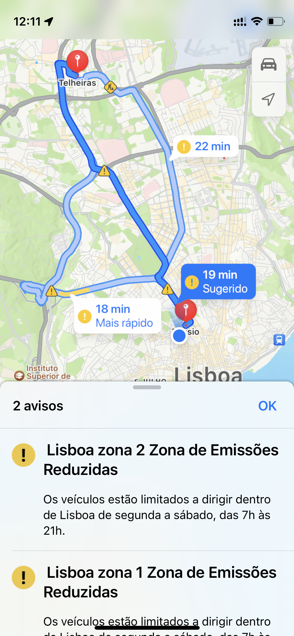
Competitor Apple Maps has been showing for some time the existing Reduced Emission Zones in several cities, including the Portuguese capital.
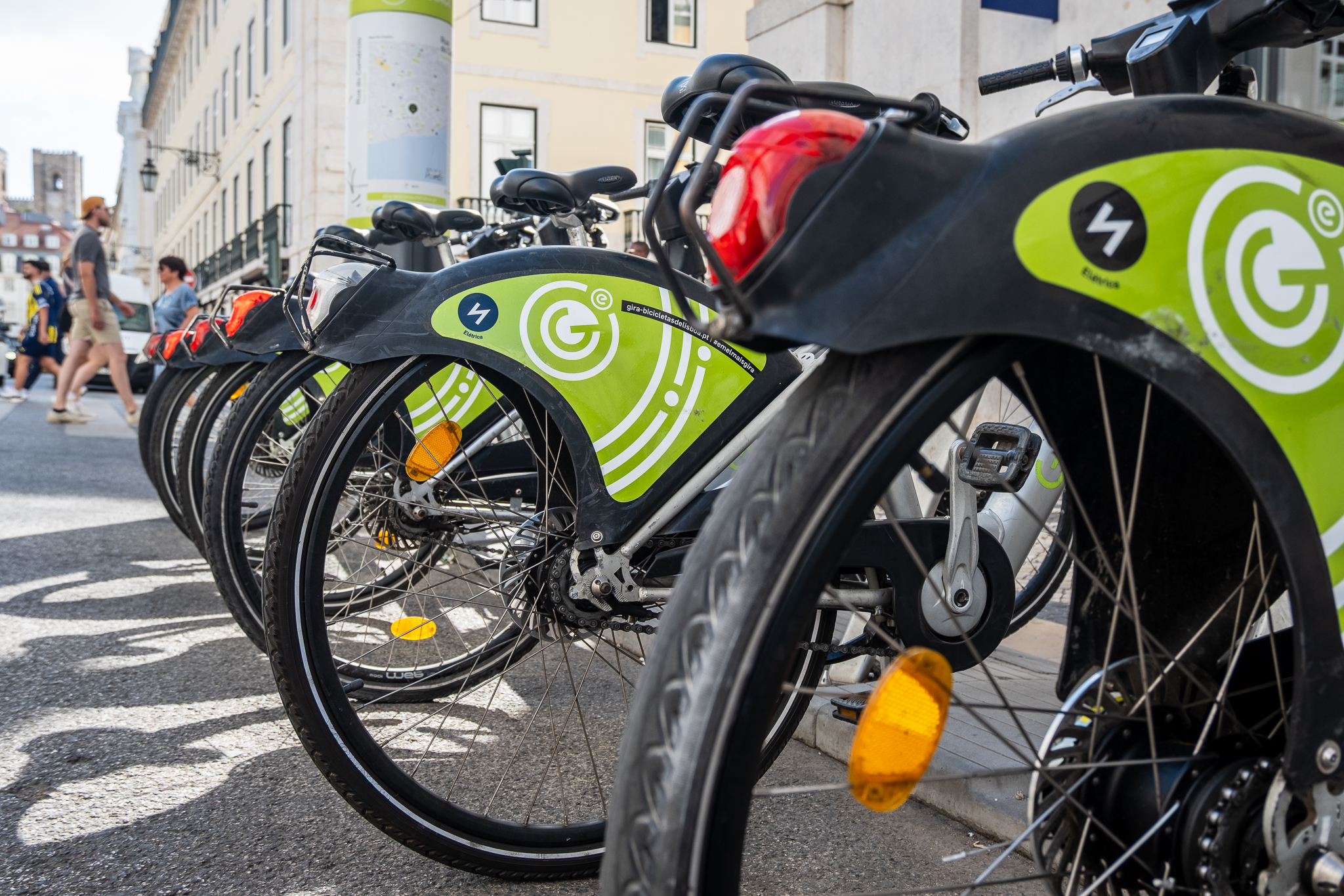
Lisbon has two ZERs

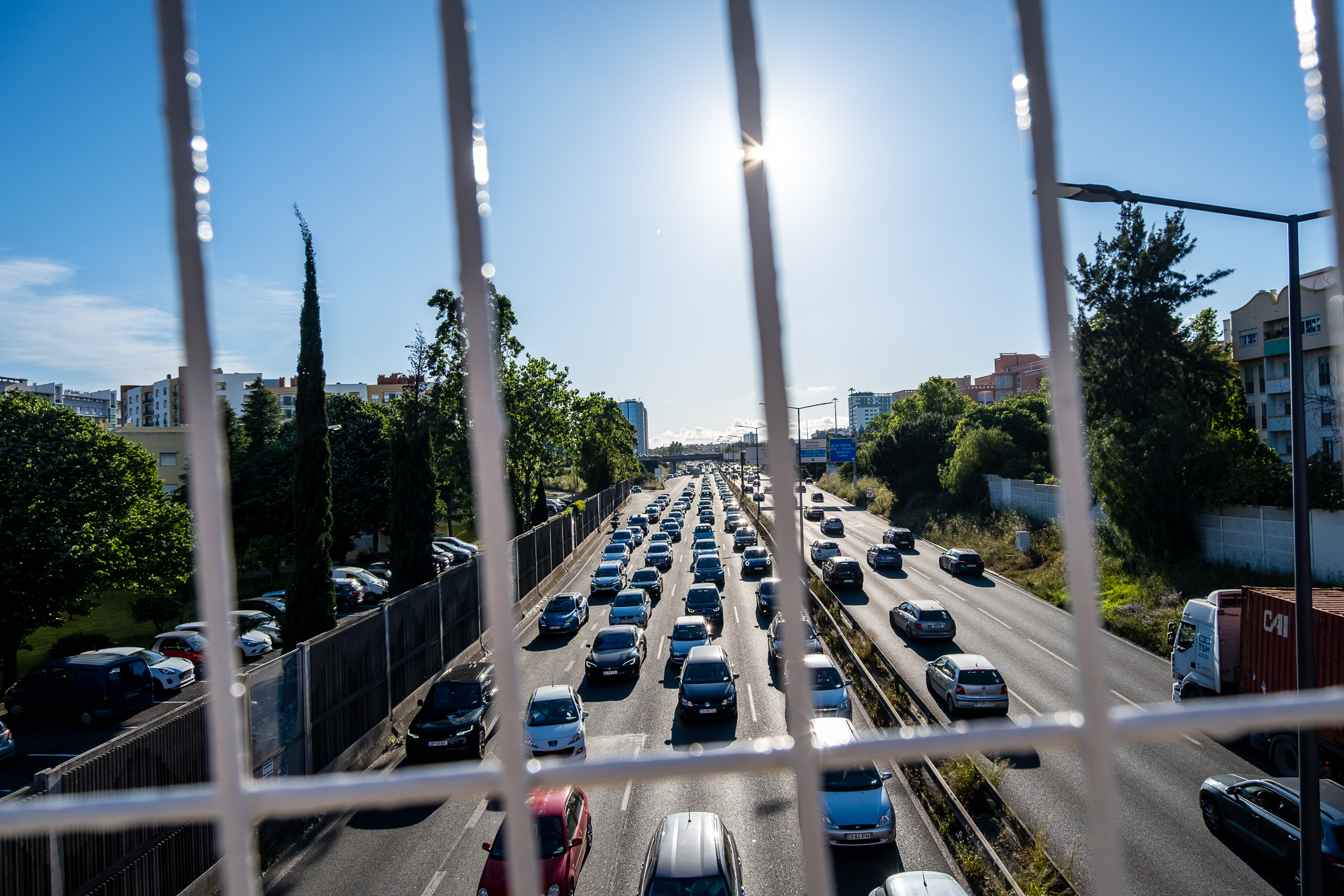
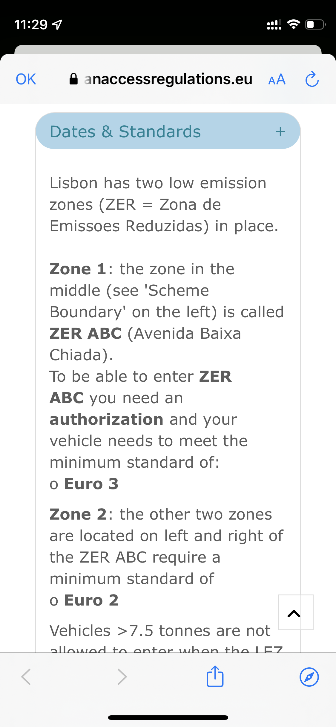
Lisbon has two Reduced Emission Zones (ZER) implemented since 2012 - a Zone 1 in the Baixa and Avenida da Liberdade area, which was originally created in 2011; and a Zone 2 that is bounded to the south by the avenues of Ceuta, Forças Armadas, Estados Unidos da América, Marechal António Spínola and Infante Dom Henrique, and the North-South Axis, and to the north by the city/river limits, and was launched the following year. The restrictions on the two ZERs have not been updated since 2015, when Zone 1 became off-limits for vehicles older than 2000 (i.e., they must meet the "Euro 3" emissions standard) and Zone 2 became restricted to vehicles older than 1996 ("Euro 2" emissions standard).
The proposal to create a new ZER - the ZER ABC - in the Avenida, Baixa and also the Chiado area did not include updates to the existing restrictions, which today, due to the widespread renewal of the city's fleet, are of little use in practice. The most recent figures indicate that of the 6.59 million vehicles in circulation all over the country, only 18% cannot circulate in Avenida da Liberdade and in downtown Lisbon, for having registrations between 1997-2000. The average age of the car fleet in Portugal is 13.2 years.
Google Maps with errors
The information about Lisbon's ZERs that Google shows in its map service is inaccurate and even incorrect. In fact, Google Maps only shows one of Lisbon's ZERs - ZER 2 - and it is not possible to find information about ZER 1, the one related to the Avenida and Baixa areas. However, the application identifies ZER 2 as Zone 1. Even when searching specifically for the other ZER, it is not possible to obtain information.
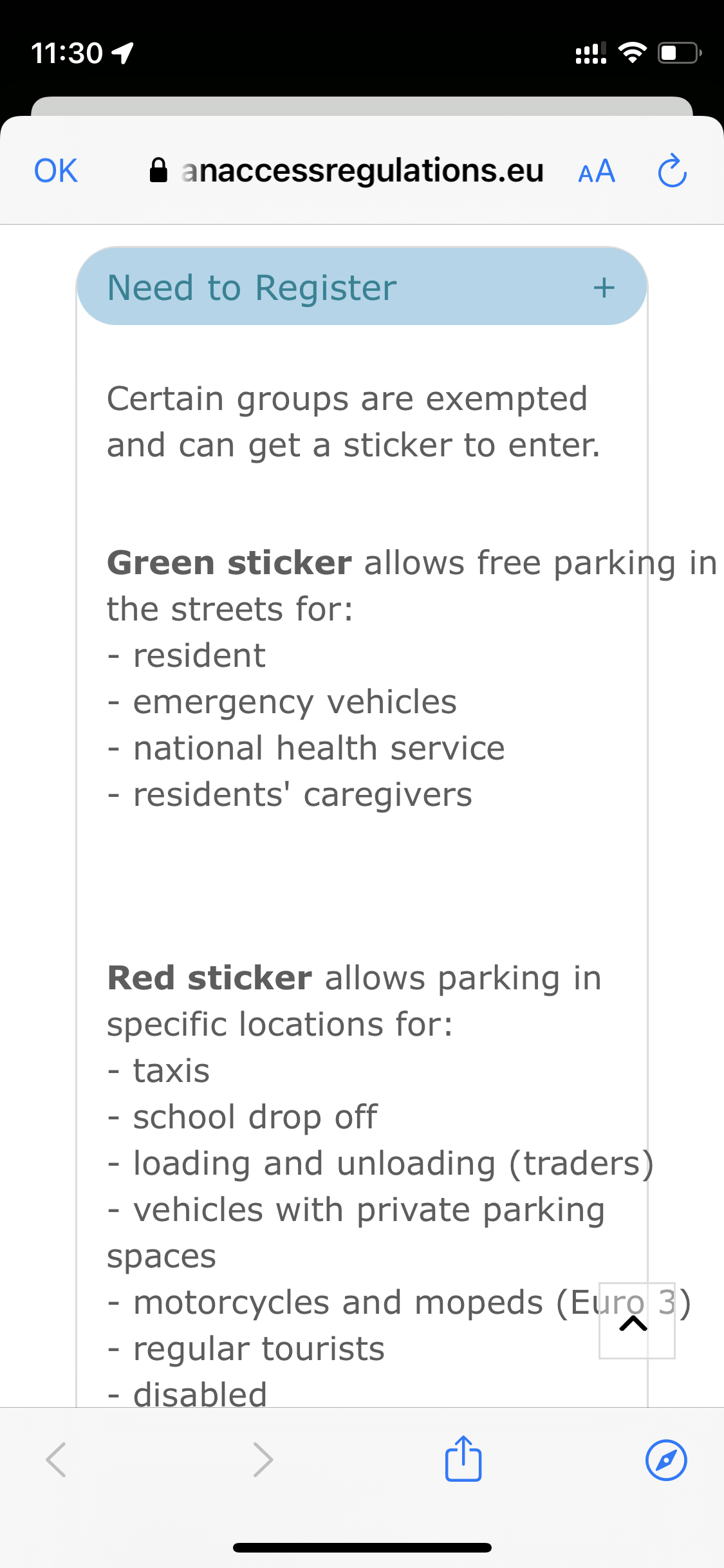
On the other hand, Google Maps directs users to a portal entitled Urban Access Regulations in European independent platform that was developed with the support of the European Commission. However, the information available on this portal about Lisbon is wrong, as details about the ZER ABC restrictions are provided that was suspended during Fernando Medina's mandate and which never came into effect.
Lisbon City Hall's official information about ZERs can be found here.
Technology is increasingly an aid to urban mobility, and navigation apps can help you understand the sometimes complex signage in cities. These kinds of warnings, uniform in every country and everywhere, can be particularly important for outsiders who are visiting a place for the first time. However, applications that we generally rely on can also present incorrect information.
Apple Maps, one of the main alternatives to Google Maps, has been presenting information about Lisbon's ZERs since at least September last year, showing correct data about the two Zones. However, like its Google competitor, Apple's map app also shows information about the non-existent ZER ABC.