A new cycle-pedestrian bridge, which is under construction in Parque das Nações, will finally allow us to cross the river Trancão and reach the municipality of Loures. Here, a new riverside route, made up of wooden walkways, will take us to Vila Franca de Xira, where there is already a trail park in the...
A World Youth Daywhich will be held next summer on the banks of the Tagus, is serving as a catalyst for some of the works to get off the drawing board. This is the case of the new Loures River Path, which will bring the population closer to the extraordinary Tagus ecosystem and, at the same time, offer the possibility of walking or cycling between Lisbon and Vila Franca de Xira. The construction of this trail started last July.
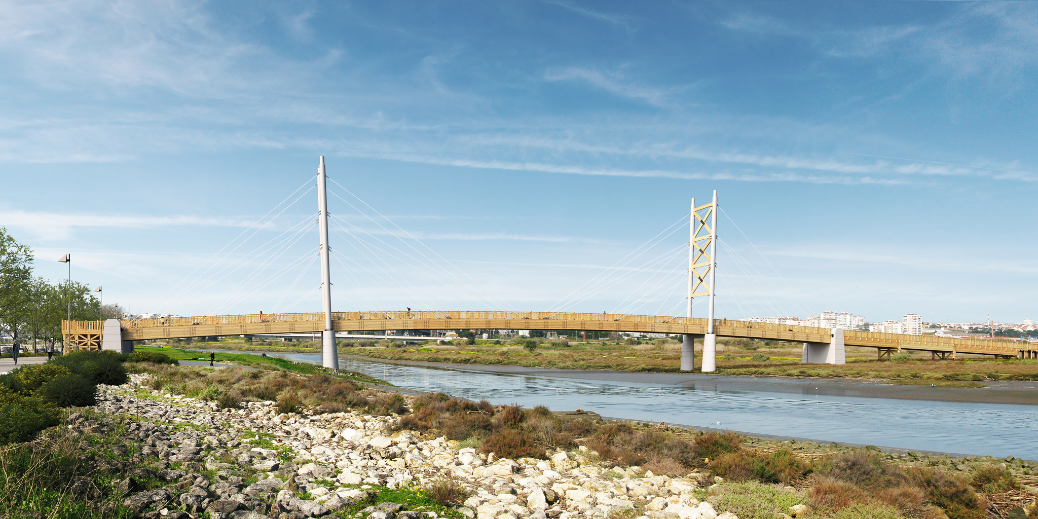
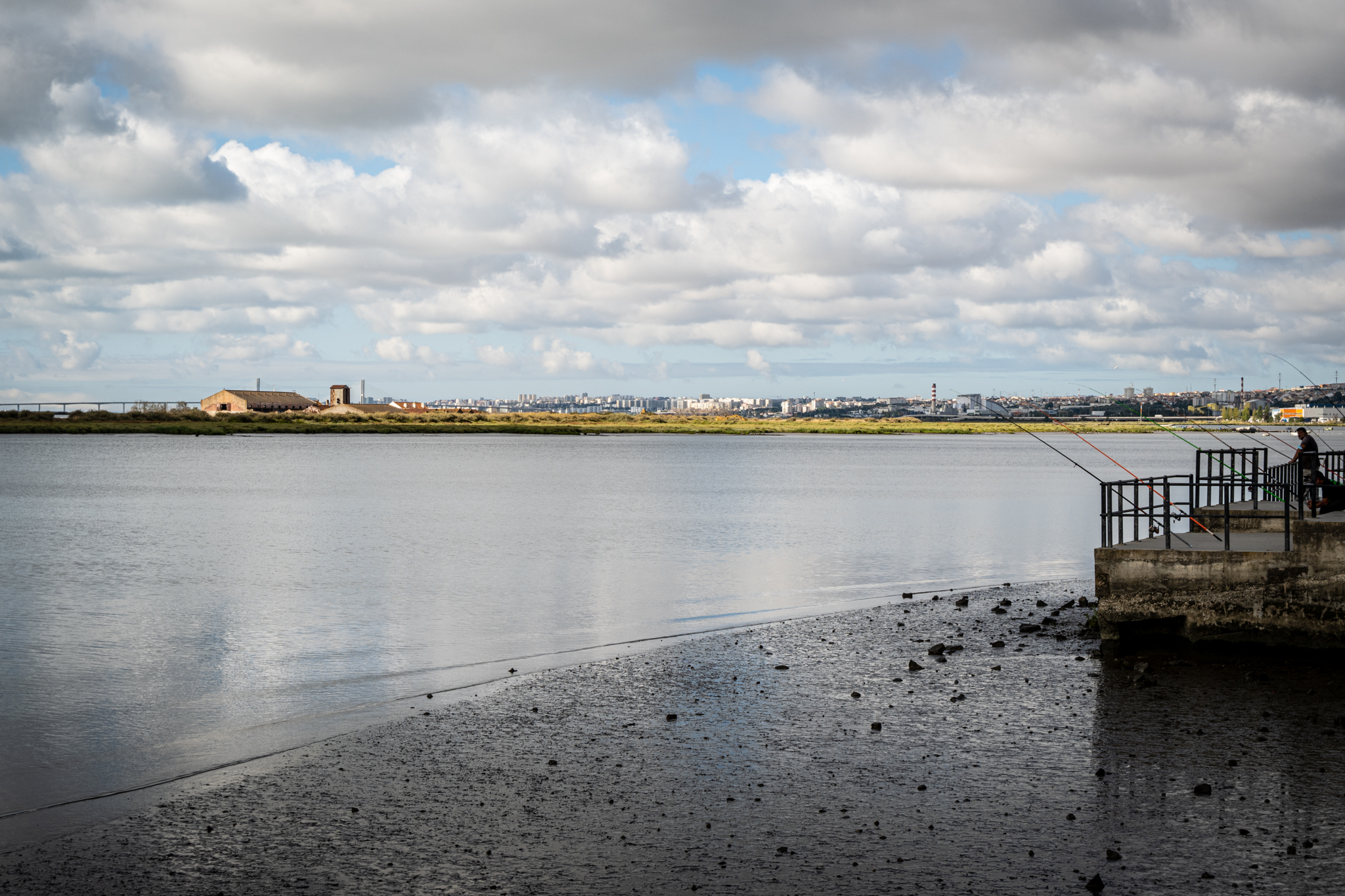
The Loures River Path will be developed along 6.1 km, between the left bank of the Trancão River and the southern boundary of the municipality of Vila Franca de Xira. To allow the connection to Lisbon, a cyclopedestrian bridge over the Trancão Riverthat will ensure the passage from Parque das Nações.
It all starts at the Trancão bridge
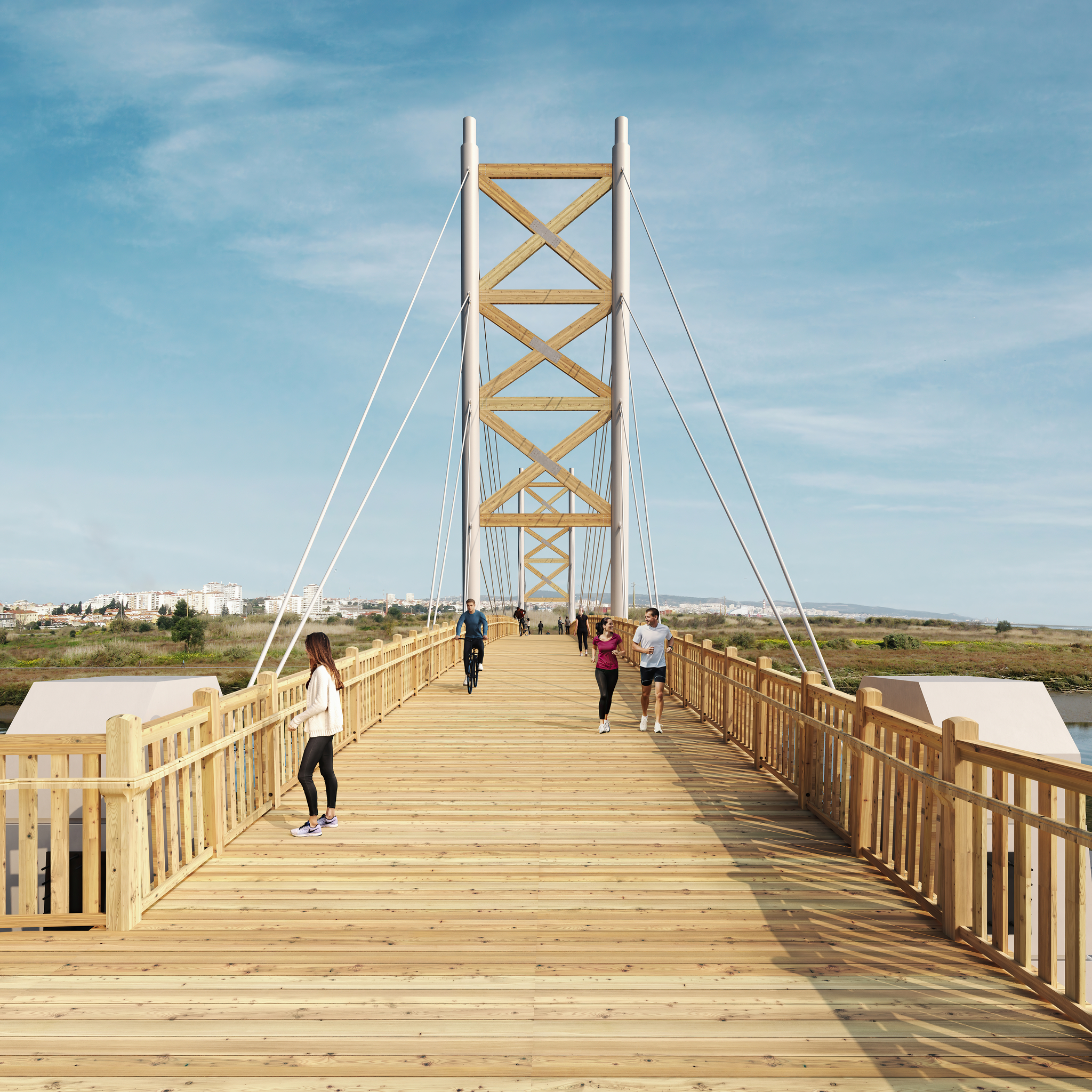
This bridge, which is EMEL's responsibility, was also designed to allow the connection between the cycling networks of the municipalities of Lisbon and Loures. It is a wood and steel structure that, on the Parque das Nações side, will be complemented by a walking and cycling path that will start at the traffic circle of the Praça Gago Coutinho, and continue along Rua da Cotovia/Passeio do Trancão to the bridge.
A Tancão Cyclopedonal Bridge construction began in September 2021 and is expected to be completed in the last quarter of this year. The project results from a total investment of 2,972,579.61 euros, with a maximum European Regional Development Fund (ERDF) contribution of 447,091.25 euros.
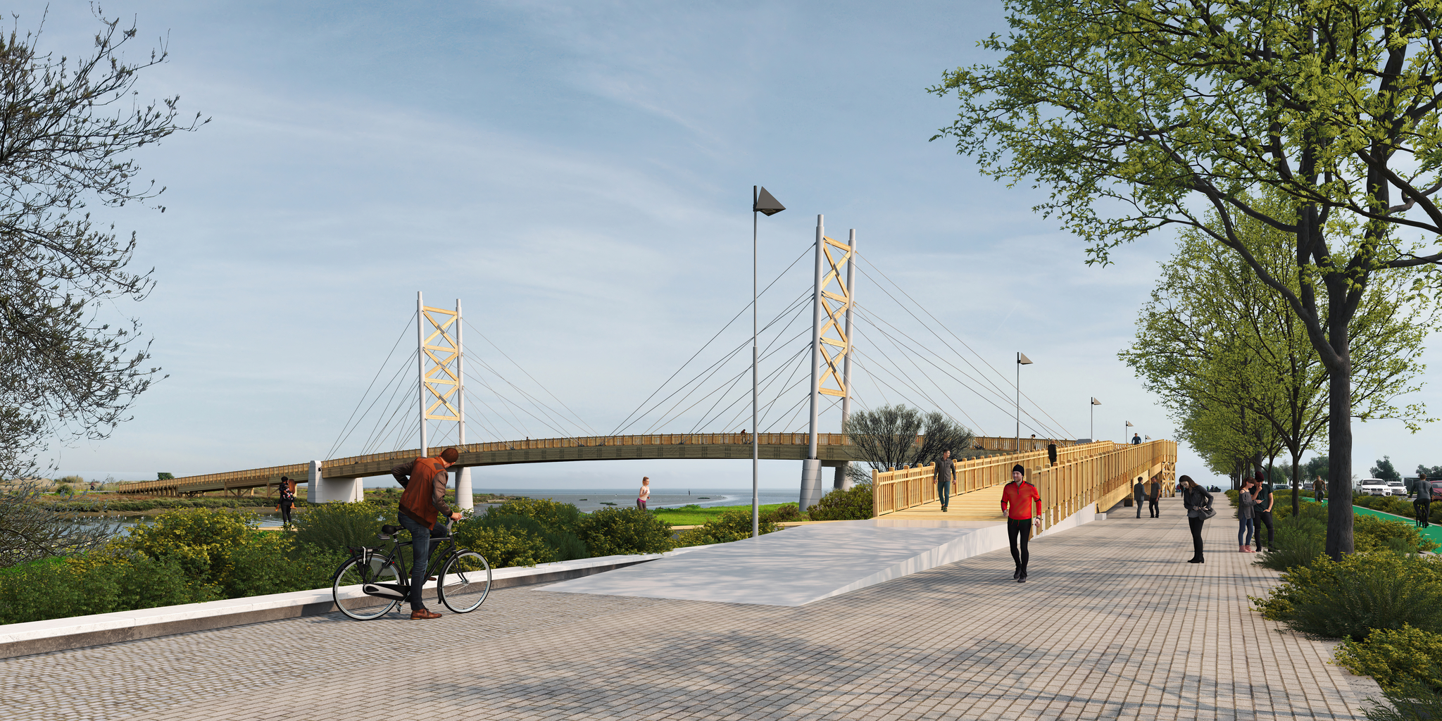
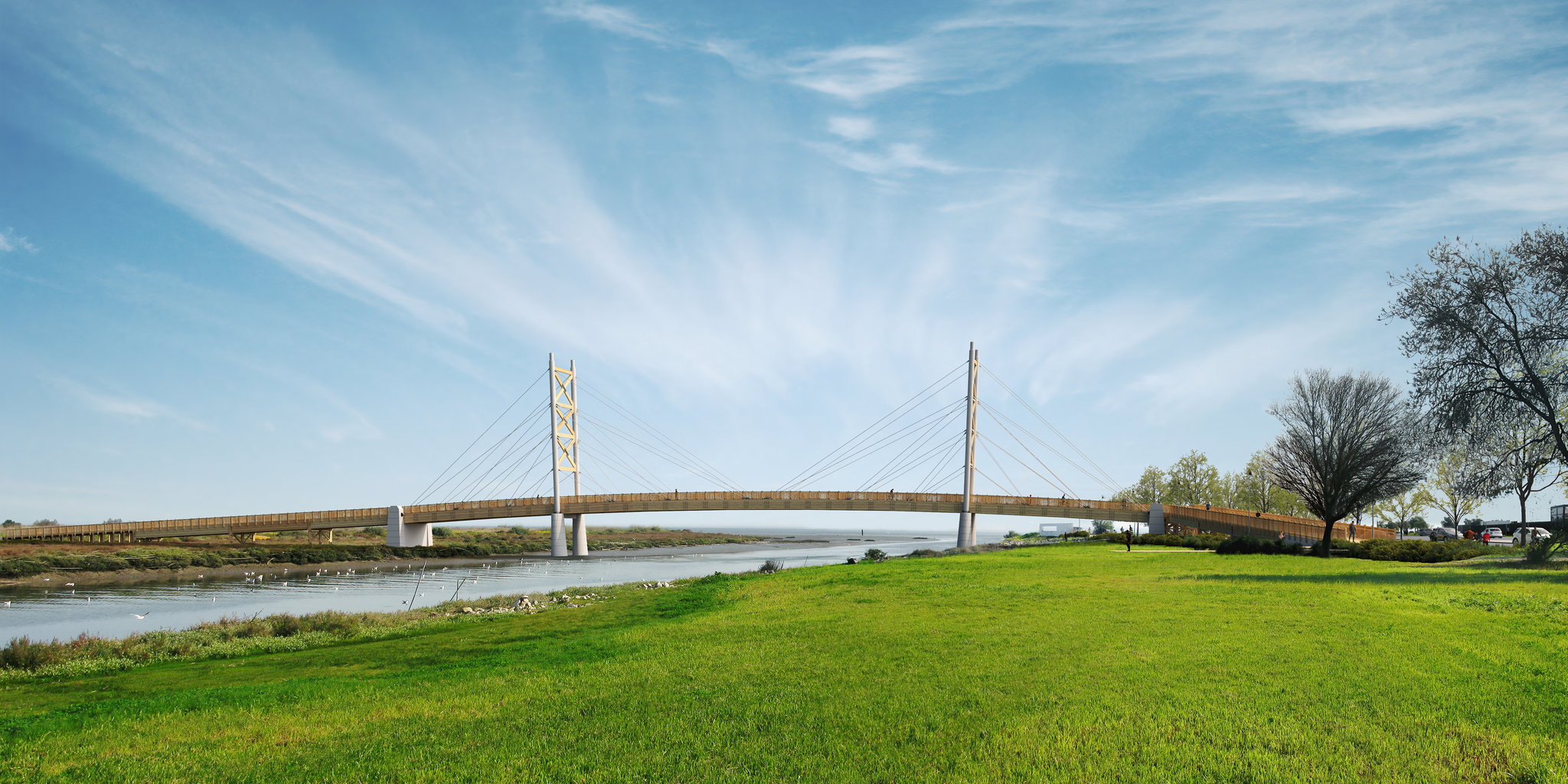
With this bridge, Lisbon and Loures will finally be connected for soft modes, allowing the marginal route along the Tagus River, which currently runs from Algés to Parque das Nações, to be extended to the municipality of Loures, in the future, in a wider itinerary, to establish the connection between Cascais and Vila Franca de Xira, with a total extension of about 60 km.
The Loures River Path, in detail
For the time being, the Trancão Cyclopedestrian Bridge will be directly connected to the Loures Riverfront Path, work on which began in July, with an estimated completion time of 10 months, and should be completed in April 2023. The initial goal of this project is to ensure pedestrian and cycling continuity between the riverfronts of Vila Franca de Xira (to the north) and Lisbon (to the south). It is also intended to promote the connection to urban areas currently confined between road and rail infrastructures, improving pedestrian mobility both to the riverside area and to adjacent municipalities.
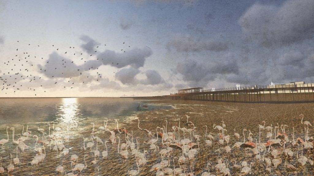
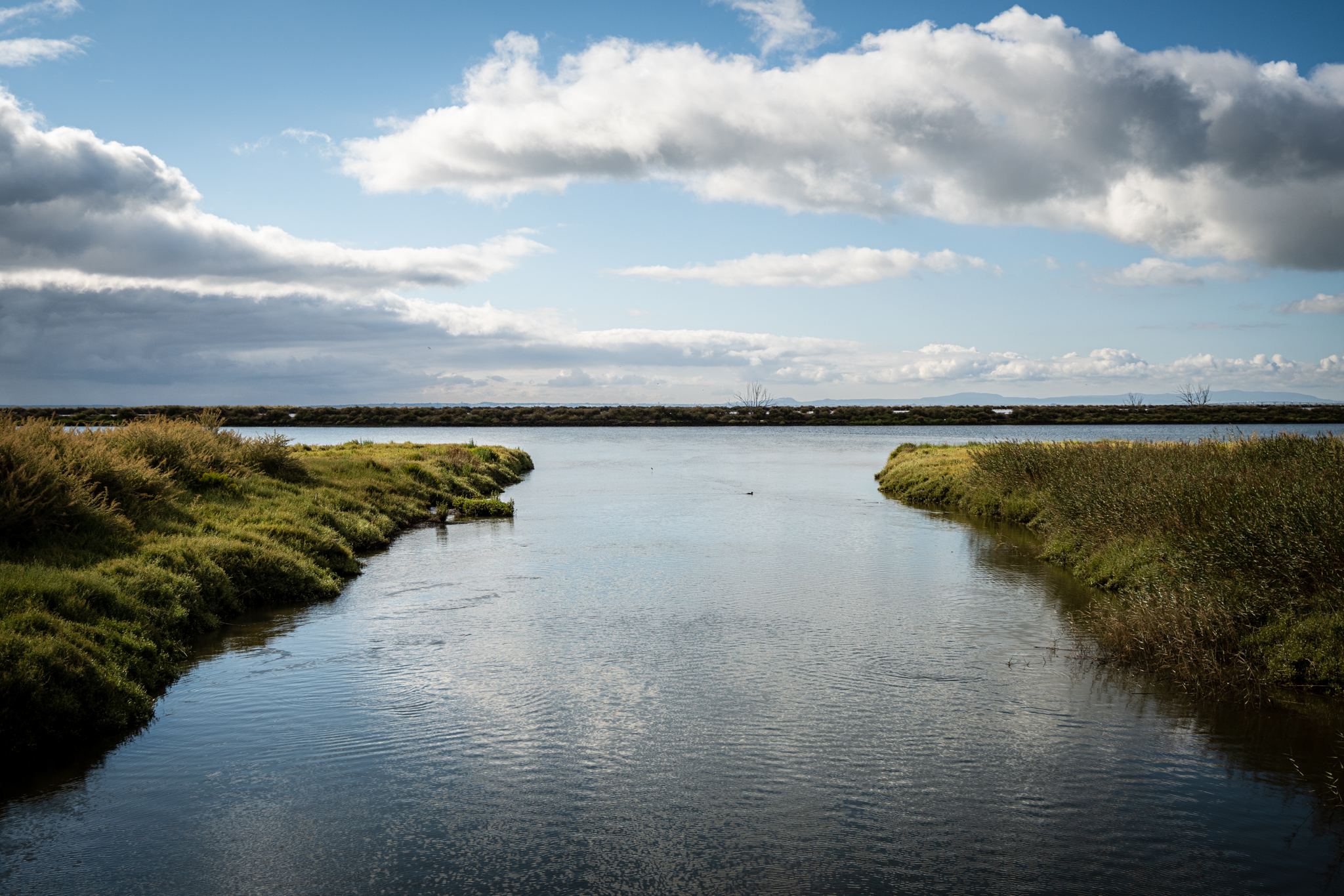
The study of the area and its immediate surroundings allowed us to discover a landscape characterized by the presence of natural ecosystems in a high pressure urban context. In the heart of the Lisbon Metropolitan Area (AML), and just a few minutes from Loures and Lisbon, it is possible to find areas of high natural value, including mudflats, salt marshes, reed beds, cistus and natural drainage lines, and to identify several types of habitats protected either by Portuguese legislation or by international agreements that occur in the Tagus Estuary area. In contrast to this exceptional landscape, in its proximity there are strong infrastructures, namely the IC2 and the railroad, as well as industrial areas that, as a whole, constitute an inevitable barrier, making it impossible for the population of the adjacent urban areas to approach the shore and thus isolating the entire Loures Riverfront.


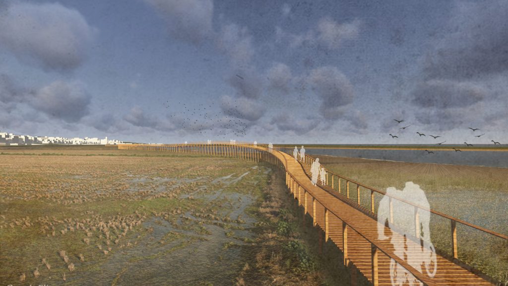
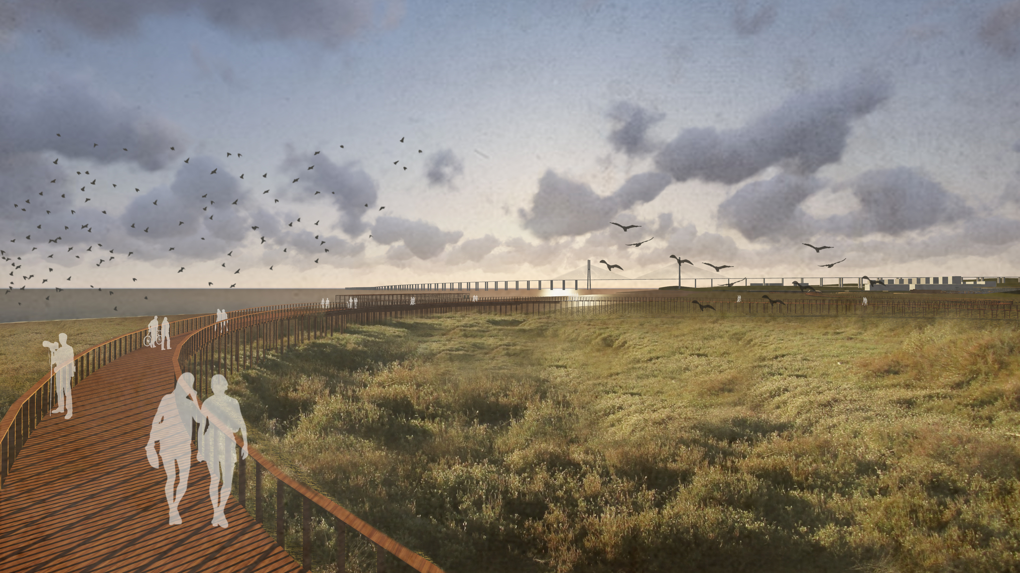
The Loures Riverfront Pathway project sought to combine the issue of mobility with the extraordinary opportunity to create a route that, besides being a recreational and leisure space, is a platform with valences in the fields of research, nature interpretation, raising public awareness to the important role that estuarine ecosystems have in safeguarding biodiversity and in the balanced management of the oceans.
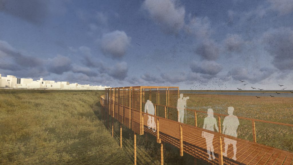
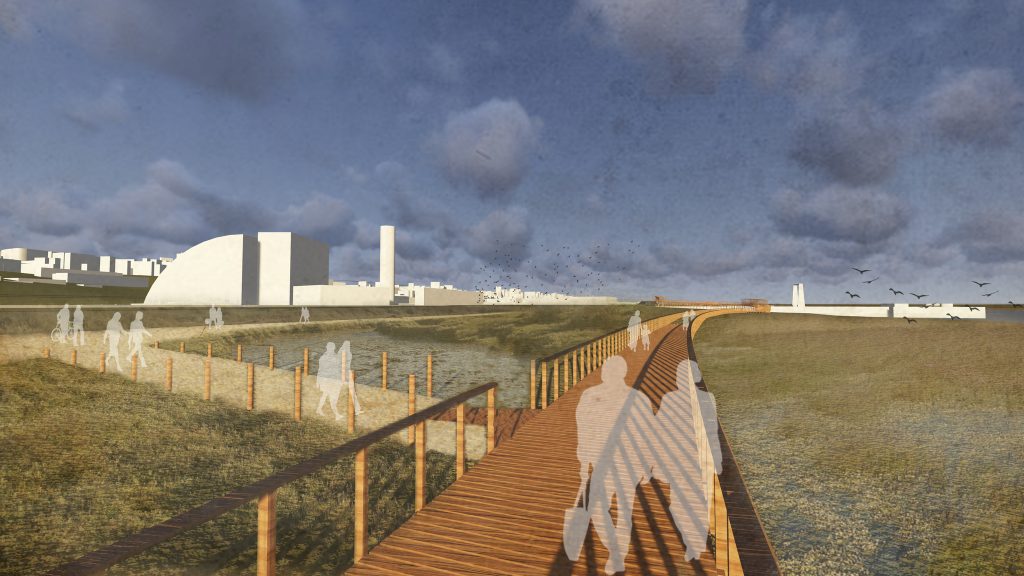
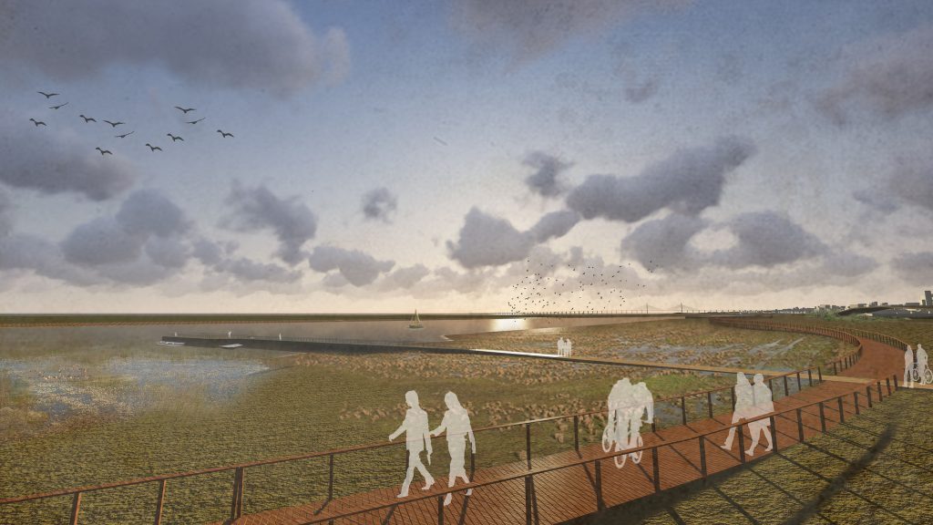
The route will be entirely on a wooden walkway on a stilted foundation with 3.5 meters wide, in order to allow pedestrian and cycling circulation. Its constitution and construction process does not negatively affect the functioning and integrity of this ecosystem. The gently undulating layout, inspired by the natural lines of this ecosystem, promotes the observation of habitats from different perspectives. Its variable elevation (between 1 and 3 meters) in relation to the existing topography allows the free circulation of water, safeguarding this structure against the occurrence of floods, while offering diversified experiences along its entire length. The mudflats, extremely important for the functioning of the salt marshes, were fully safeguarded.
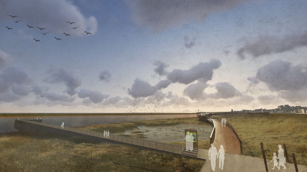
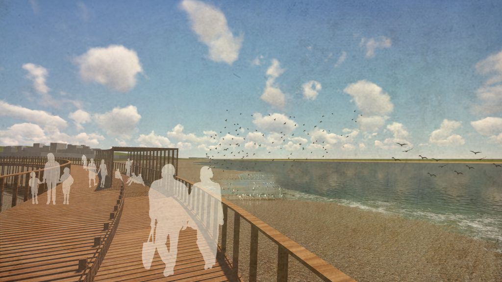
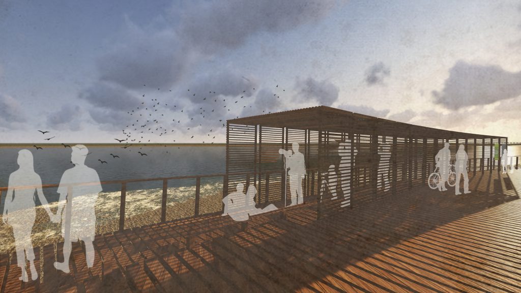
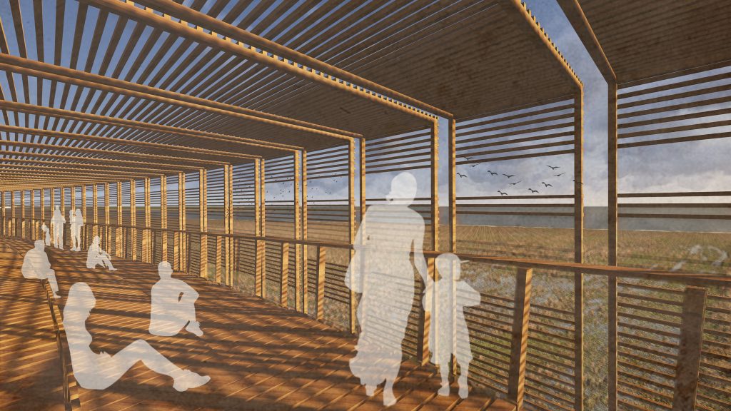
Along the riverside path, there will be five observation and lodging pointsThese structures are slightly overhung from the main path, shaded with wooden slat and equipped with benches to provide the path with comfort levels adjusted to the length of the walkway and the microclimate of the site, particularly during the summer period.
The route will also have shadow tunnelsThe walkway is made of wooden slats, where passers-by, whether on foot or by bicycle, can slow down, and even stop for a few minutes. Near the kilometer 4.7, the walkway intersects an existing pontoon - the Pontão da Fima. This pontoon will be integrated into the route, allowing you to visit it. In the first phase of this project, in 2017, the route from the Santa Iria halt station to the BP pontoon was implemented, which is another cross connection to the main route.
In Vila Franca de Xira
On the Vila Franca de Xira side, the municipality is working on Tagus Estuary River Linear Parkwhich will connect with the Loures Riverfront Trail in the Póvoa de Santa Iria area. In total, this Parque Linear Ribeirinho will have about 16.9 km of linear length and will be composed of different trails, namely: the Póvoa de Santa Iria Trail, the Tagus Trail, the Forte da Casa Trail, the Verdelha Trail, the Station Trail, the Comportas Trail and the Salgados Trail, the Mill Trail, the Estaleiro Trail and the Tesos Trail. Some of these trails include parts on wooden walkways.
In its first phase, the Tagus Estuary Linear Park will extend from Praia dos Pescadores in the south to the future Passadiços dos Salgados in the north; in a second phase, the Linear Park will be extended to the Sobralinho area. Currently, the Parque Linear can already be visited in some sections, which include the Parque Ribeirinho dos Moinhos da Póvoa, the Ciclovia do Tejo, the Parque Urbano da Póvoa de Santa Iria and the Praia dos Pescadores - you can see on the following map, with dashed lines, the sections already built. In color are the stretches of the 1st phase that are still to be done and whose work was scheduled to start in 2022.
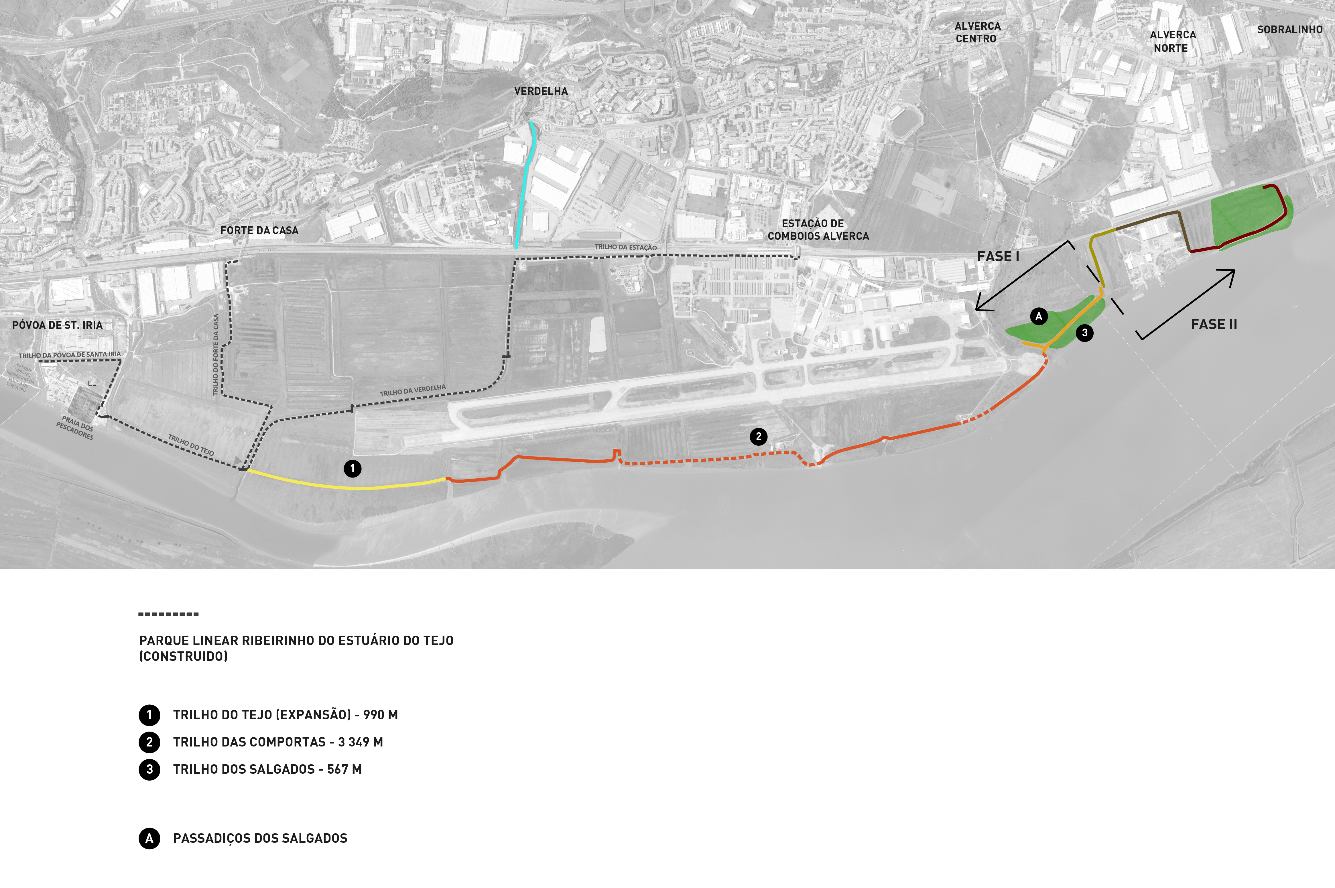
The expansion project on the table involves an extension of about 4.9 km and an area of approximately 7.6 hectares, which includes three trails - the extension of the Tagus Trail with an extra 990 meters; the Comportas Trail with 3.32 km; and the Salgados Trail with 594 meters. This expansion also includes a unique zone, but we'll get to that in a moment.
The three trails will be developed mostly on structures in combro, which present along their linear development different characteristics, in their implementation were taken into account their types, and small restorations and regularizations will be made, in order to stabilize and strengthen these ancient structures without distorting their characteristics, nor change the morphology of these corridor spaces. In cases where altimetry is less favorable, raised wooden walkways are used.
The Lock Trail that runs between the riverfront and the edge of the Alverca Military Airfield owes its designation to the fact that it is complemented by a system of six locks / tide gates, which the project includes the repair of three of these structures, which control the ingress and egress of water in the lower parts of the airfield in accordance with the regime of the tides, minimizing the possibility of flooding in extreme situations of rising water levels of the Tagus River.
The unique area we mentioned before is the Passadiços dos Salgados - will be 1.12 linear km of walkways over the Salgados community areas (caniçal, juncal and salt marsh), a wetland of great ecological and environmental importance, located north of the Silveira River, after the Aerodrome. The implementation of a network of paths on raised wooden platforms will allow for pedestrian circulation associated with the observation, study, and contemplation of habitats and landscape, controlling and minimizing human pressure on ecosystems and allowing for their functioning and recovery process.
The layout and overhang of these walkways are intended to minimize the direct and indirect impact on the natural system, as well as the risk of it being destroyed by the river current in the event of extreme phenomena. Given the size of this unique area with about 5.7 hectares, we recommend equipment that will allow visitors to choose more interactive spaces related to environmental educationThese are either for birdwatching only, or simply for recreation and rest. To wit:
- two bird watching postsThe platforms will be adjacent to and level with the walkways, equipped with benches and wooden slatted roofs;
- three Nature Observation stationsallowing the global observation of this ecological area of salt marshes. In addition to its function of being and observation, these infrastructures will acquire an architectural importance, acting as elements of reference of the space and also of aesthetic enhancement of this landscape;
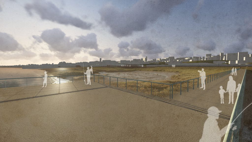
- three zones of stay and contemplationThey will be made up of wooden platforms with benches for resting and relaxing, and will allow for the practice of artisanal fishing;
- five shadow tunnels located on various sections of the walkways will provide areas of shade in the hottest seasons. These tunnels will also reduce the impact of the presence of visitors on the permanence of birdlife.
The routes and the different living areas will be accompanied by signage for guidance, but also information to support the recognition and identification of habitats, flora, and fauna. From the Salgados Passages, the Tagus Estuary Linear Park enters its 2nd phase, which has no dates set yet. This 2nd phase will extend to Tesos Beach, through the following trails: Moinho Trail (382 meters); Estaleiro Trail (540 meters); and Tesos Trail (723 meters).
To Lisboa Para Pessoas, the Vila Franca de Xira City Hall explained that the area affected to this Linear Park is a strongly conditioned zone, both from the point of view of ecological resources and other constraints - for example, some areas are maritime domain, others fall under the jurisdiction of the Lisbon Port Authority. For this reason, in the various development phases of the project, there was "the need and legal obligation to consult all intervening entities with jurisdiction in the territory concerned".
This process led to the construction of the Linear Park having to be segmented. The project for the execution of what remains of the 1st phase has been concluded since March 2021 and approved by most of the entities involved; the vila-franquense municipality expected that the construction work would start during this year 2022.
For the Municipality of Vila Franca de Xira, the "the expansion of the Tagus Estuary River Linear Park will become an important green corridor in the Lisbon Metropolitan Area"that will allow the requalification of pre-existing structures along the Tagus river estuary coastline and create "a unique landscape frame". The Linear Park will offer a bicycle path along the right bank of the river, go through agricultural areas in production and abandoned ones, cross the Alverca Military Airfield, pass by industrial plots in operation and deactivated ones, and visit wetland and marsh habitats.
The municipality of Vila Franca de Xira believes that "the size and the multiplicity of uses and experiences of this Park will have a strong attraction, not only on the adjacent communities, but also for those coming from the more distant urban areas".