Chronicle.
The popular CityMapper app has introduced a new feature that allows you to find out about accessible routes in Lisbon. This new feature is a significant step forward, but the basic problem - the lack of georeferenced information on accessibility - remains unsolved, as there is no local investment in collecting data to make it available.
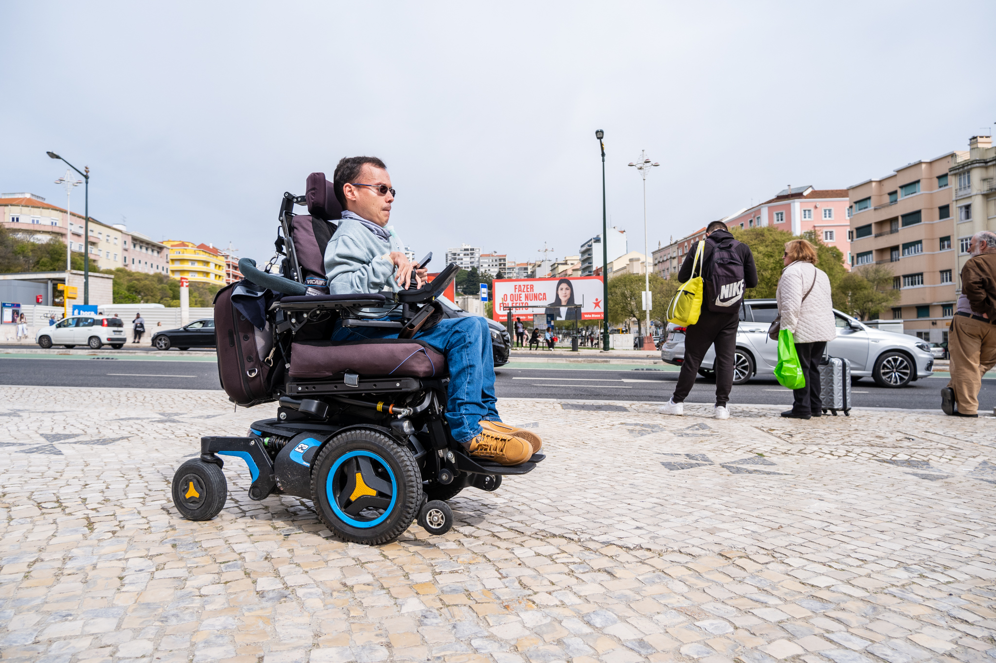
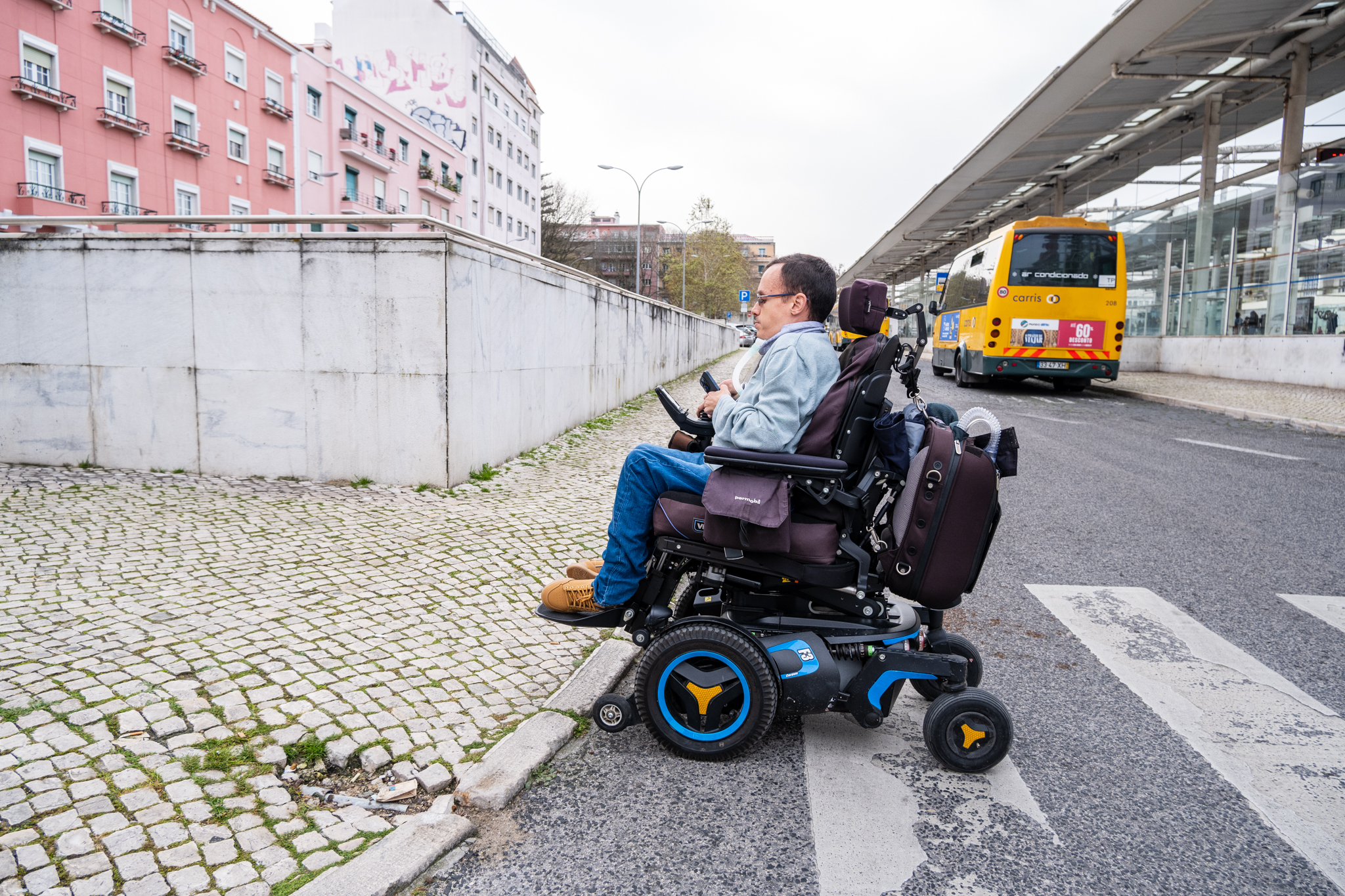
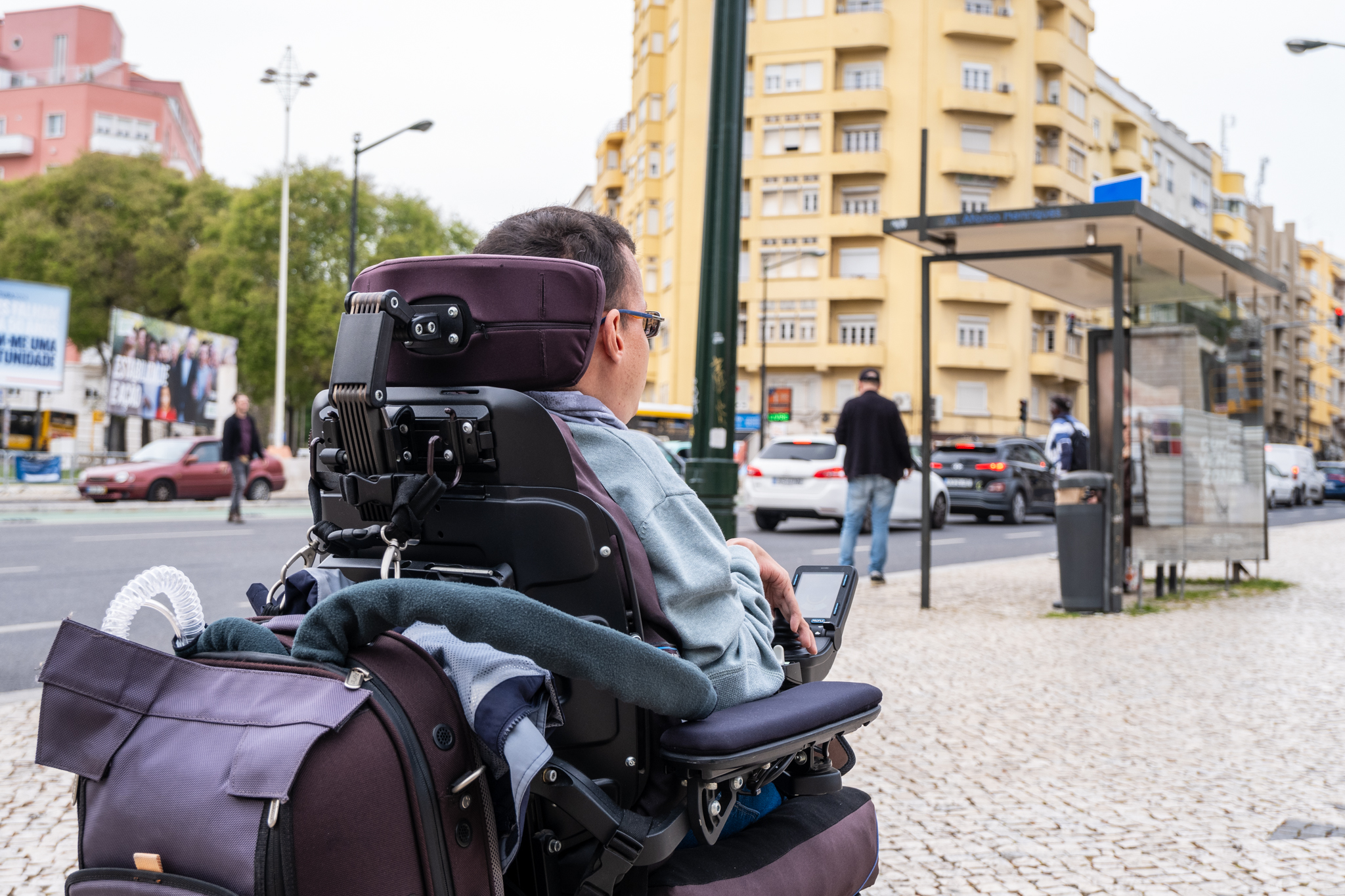
Recently, one of the best navigation apps for commuters without a car, the CityMapperhas launched a new feature that allows us to find out about accessible walking routes and public transport. This is particularly important for me, as I use an electric wheelchair. With this new feature, I thought that CityMapper would have all the information I needed to get around, from the state of the elevators in Metro stations to the obstacles on the sidewalks, not to mention the vehicles suitable for people with disabilities.
But after trying out the new feature in the field, I realized that there is still a lot to be done. There is still information missing for CityMapper to be a app accessible.

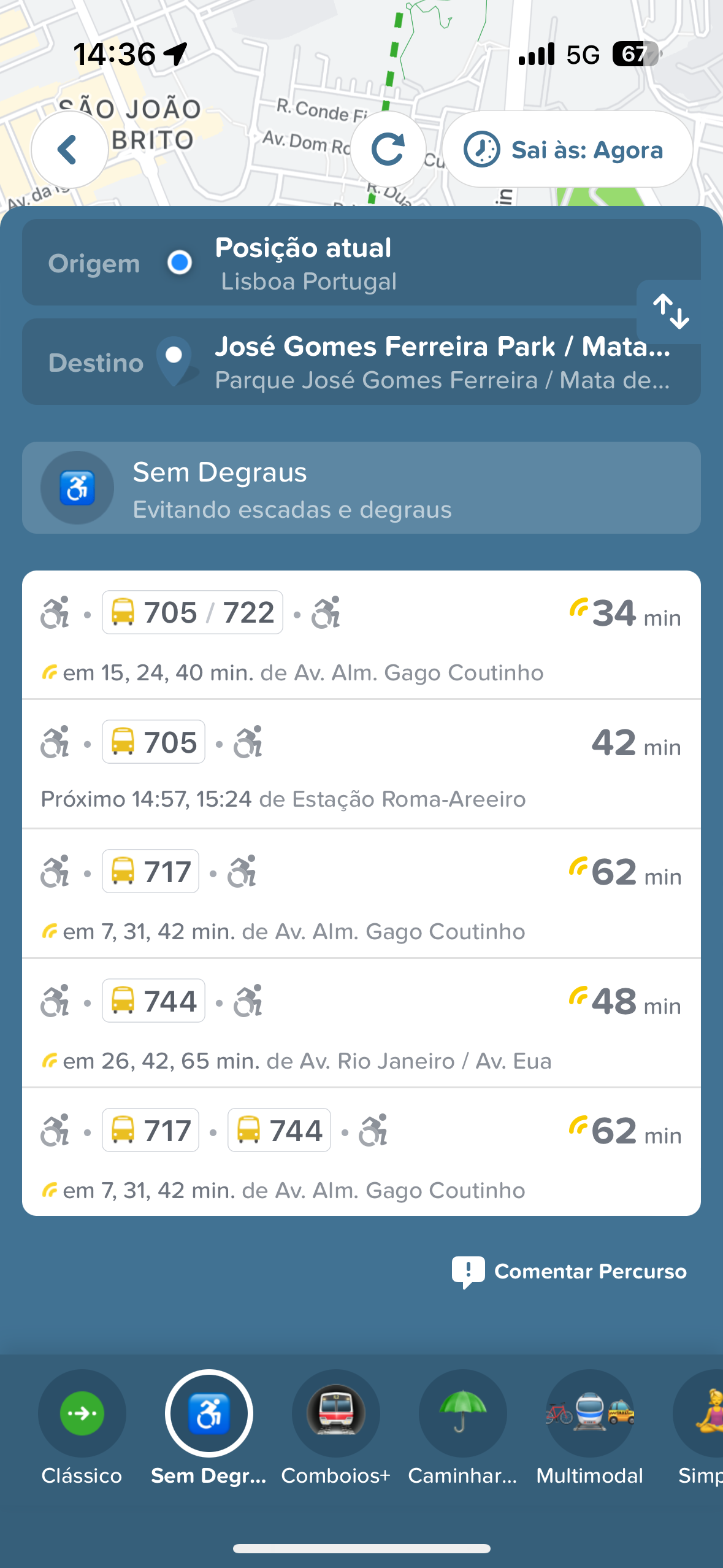
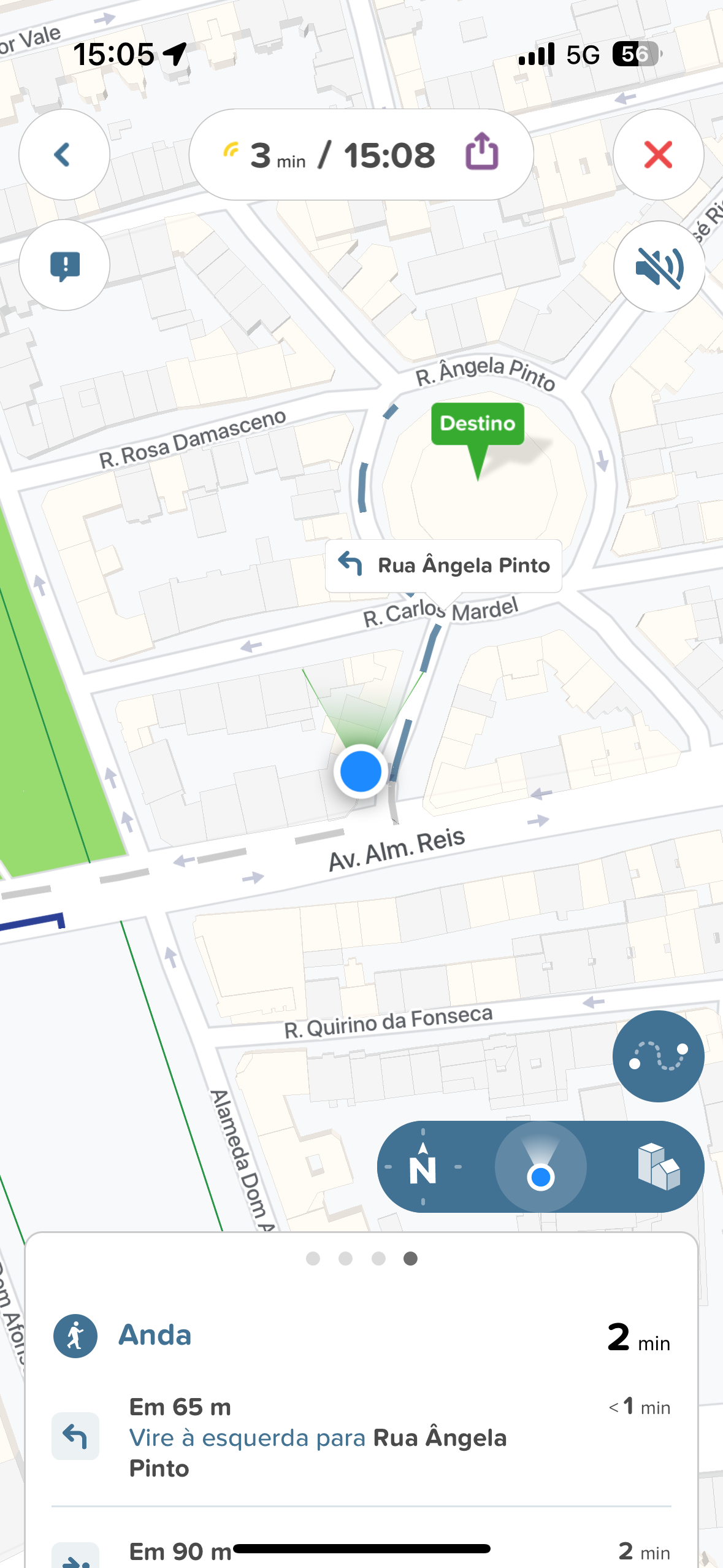
I went to Areeiro to test the new CityMapper feature. Before I left, I did a few test searches to see how the app behaved and the results it showed. Right away I ran into the first issue: the information isn't detailed enough to tell you the exact route on a street, so don't be surprised if it says you can go down a certain street but doesn't tell you which side it's on (right or left).
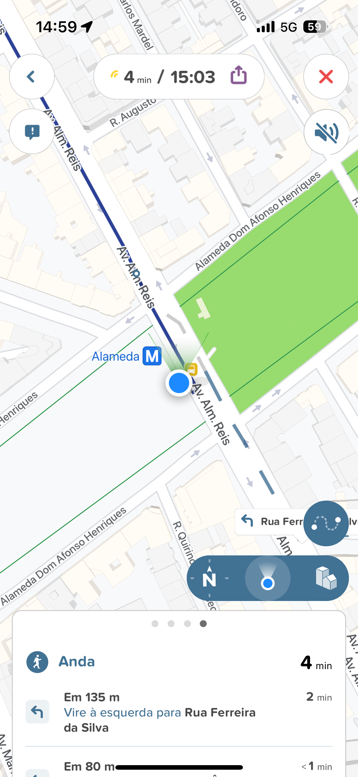
In my case, I tested a walking route between the Roma-Areeiro train station and the Alameda Metro station, which resulted in Avenida Padre Manuel da Nóbrega. On this artery, a wheelchair user can't go up the left-hand side, towards Praça do Areeiro, because at a certain point the sidewalk is interrupted by an inaccessible section, and even the bus stops on this section are inaccessible. However, CityMapper tells us to go that way because it doesn't have enough information to calculate the route to avoid inaccessible sections.
As for public transport, the application provides some important help. The information on the state of the Lisbon Metro's elevators is integrated and allows CityMapper to calculate the results depending on whether the elevators are working or not. However, I found that there were errors, since on the day I did this test Alameda station was still undergoing work to replace several of its elevators. This information was on the Lisbon Metro website, but CityMapper was unaware of it and told me to take the Metro at Alameda.
Over the years, various organizations have identified the lack of information on accessibility as one of the major problems in managing this issue. Identifying what is and isn't accessible in a city, as well as providing results on the state of public facilities, such as elevators and entrances, is still an unsolved challenge, and several projects have emerged in Lisbon as part of the VoxPop initiative. In most cases, the solutions have been to create applications that segregate information. app tells me if a restaurant is accessible at the entrance level, with no steps, but to find out if the toilet in that restaurant is accessible I have to consult another application. The basic problem - the lack of georeferenced information on accessibility - remains unsolved, as there is no local investment in collecting data to make it available.
Back to our test. I searched for a route, this time a real one, between Roma-Areeiro train station and Arroios Market. The app gave me the correct information, with the route to the stop on the 718 Carris bus, which leaves from the train station door, then a trip on this bus to Alameda and, from there, a pedestrian route to the Mercado. From its list of accessible Carris routes, CityMapper indicates which ones are suitable for wheelchair users like me. Not all accessible routes appear, such as the Carreiras de Bairro, perhaps because the rolling stock is variable and not stable on a given line.
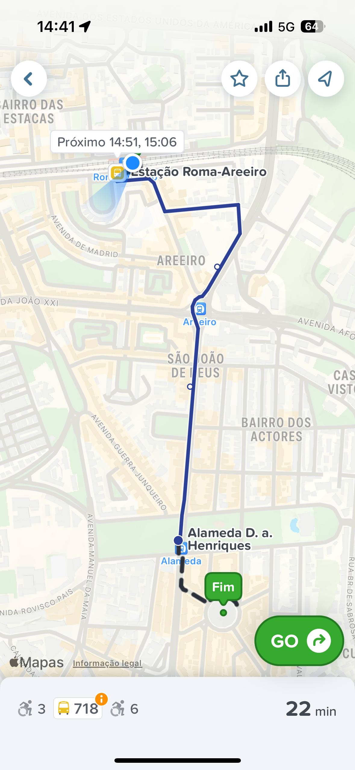
I didn't have any problems on the 718. I took this bus twice, once to go and once to come back. On one trip, the driver had to move the ramp; on the other, the ramp was automatic and it was easier to get on and off. On the route between Alameda and Mercado de Arroios, I had no problems, as I found lowered sidewalks next to the crosswalks and an obstacle-free route. But we can't expect CityMapper to show us where the accessible entrance to the Arroios Market is, for example, because, as I said before, there is no information about this detail anywhere - neither on CityMapper nor on Google Maps.
On another route that I tested - but didn't carry out - I wanted to see if it was possible to give results for a longer, more complex route. I tested from Areeiro to Rossio in the hope that, among the various options, it would give a route with bus and Metro. The results always gave the train option, not to mention that to use CP trains you have to book six hours in advance. In other words, I could never take the route that CityMapper was giving me at that moment, spontaneously. The app doesn't give me any information about this CP condition either.
It should be noted that CityMapper does not at any time promise to provide guaranteed accessible routes, but it does create that expectation. The truth is that app is limited to indicating public transport options for people with reduced mobility and walking routes without stairs, and even in this task it has flaws that could leave someone like me stumped. The travel times indicated in the app are, in fact, adjusted for the extra time it takes to travel the streets in a wheelchair or using elevators, which gives a more realistic idea of how long it actually takes to get from point A to point B. The information on which buses are accessible is also in line with the information provided by Carris.
All in all, this new feature in CityMapper is a step in the right direction, as it is a common app that can be used by anyone and now provides information on accessibility, avoiding the painful process of installing yet another app just to have segregated information. In many cases, these dedicated apps are not of sufficient quality and end up losing support a few months after launch. But the rest is missing: information on accessibility needs to be collected and made available in a standardized and effective wayallowing you to equip not only CityMapper but also other apps such as Google Maps.