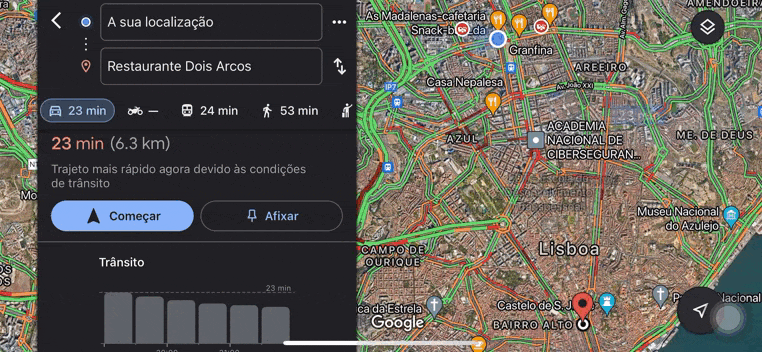
Funcionalidades no Google Maps era há muito aguardada por quem se desloca de bicicleta na cidade de Lisboa.

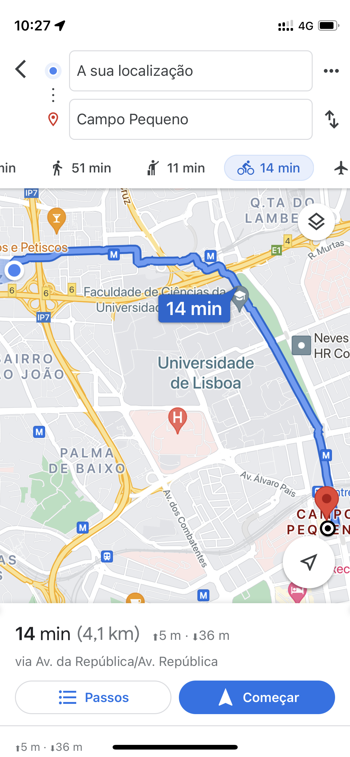
O Google Maps já fornecia indicações para viajar de carro, transportes públicos ou a pé e, a partir de agora, começa a disponibilizar ao utilizador direcções para andar de bicicleta não só em Lisboa mas Portugal, permitindo-lhe seguir todas as instruções de navegação por ciclovias existentes, percursos ciclopedonais e por estrada que não sejam vias rápidas.
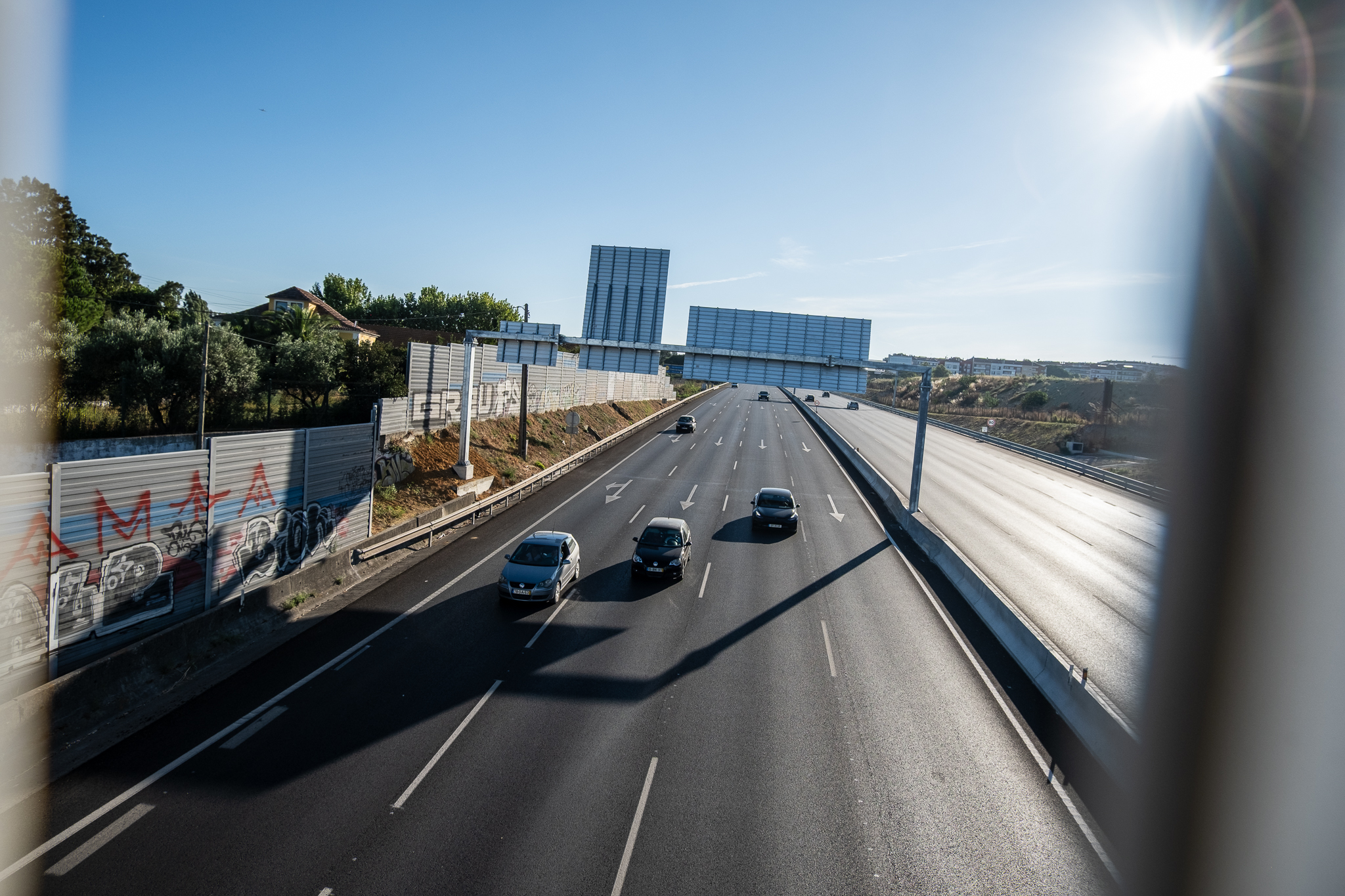
Era uma falha do Google Maps: quem fizesse uso da bicicleta como meio de transporte tinha de se desenrascar entre as direcções para automóveis (que podem sugerir vias rápidas) e as para peões (que podem incluir ruas de sentido único ou escadarias). O melhor mesmo seria conhecer a cidade ou optar por ciclovias, mas nem sempre as há e nem todas as pessoas têm bom sentido de orientação ou estão numa cidade que conhecem bem.
As direcções para utilizadores de bicicleta chegam ao Google Maps por pressão das equipas da Câmara Municipal de Lisboa, no anterior executivo, tendo a Google colaborado também com a plataforma comunitária Ciclovias.pt, que mapeia as ciclovias existentes a nível nacional com a ajuda dos dados disponibilizados pelas autarquias e de contributos dos ciclistas, e com o projecto Ciclovia.pt, que agrega sobretudo informação sobre ecovias e ecopistas.
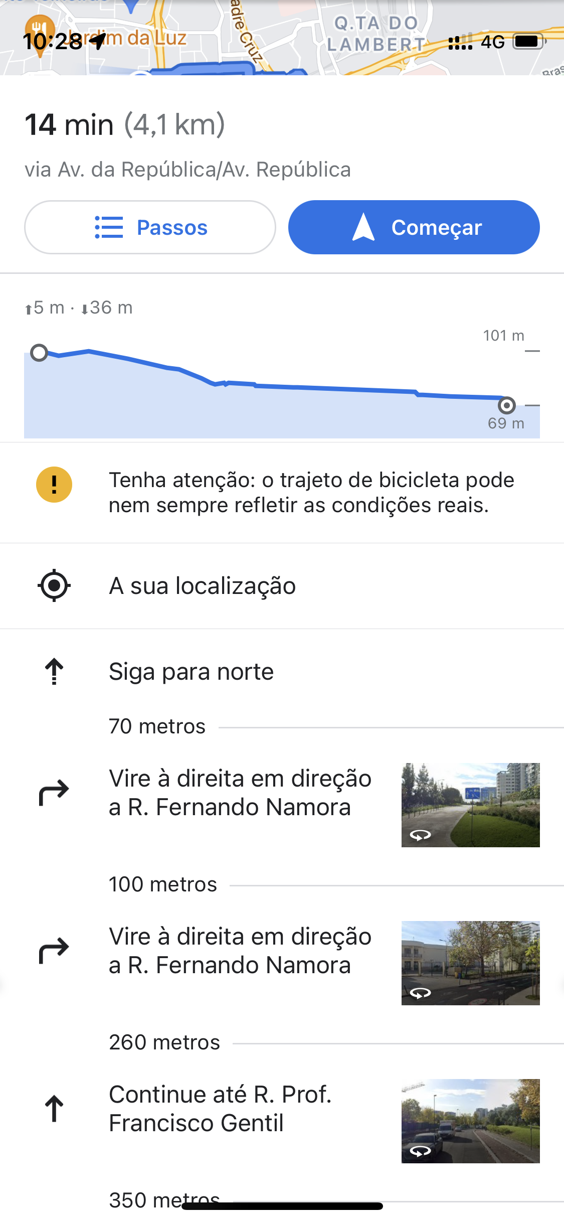
“Com todas estas informações conseguimos ajudá-lo mostrando-lhe a melhor rota para chegar a pedalar ao destino pretendido. Para esta análise, levamos em consideração os vários tipos de ciclovia e quais as ruas próximas que talvez não sejam adequadas para bicicletas (por terem túneis, escadarias ou buracos na estrada)”, lê-se num comunicado da Google Portugal. “Os utilizadores poderão também ver se o percurso é plano ou íngreme e assim prepararem-se para uma viagem mais tranquila ou com maior esforço.”
A Google diz que os municípios podem agora dispor da ferramenta Geo Data Upload Tool para disponibilizar informação em falta e garantir que ciclovias novas aparecem no Google Maps. Mas a tecnologia acrescenta que “para disponibilizar o percurso mais actualizado”, vai recorrer a algoritmos de aprendizagem automática para analisar o “mundo real” através de “imagens, informação de entidades públicas e contributos dos utilizadores”.
As estimativas de tempo são feitas tendo em conta uma bicicleta convencional, podendo ser mais reduzidas no caso de bicicletas eléctricas. Através do Google Maps, podemos agora comparar a bicicleta a outras formas de mobilidade e saber qual o meio de transporte mais competitivo em termos de tempo para determinada deslocação na cidade (ou fora dela). “De carro, a pé, de transportes públicos e agora de bicicleta, o Google Maps em Portugal ganha mais uma funcionalidade para continuar a ser útil em todos os momentos e em todas as suas deslocações e descobertas”, remata a Google Portugal.