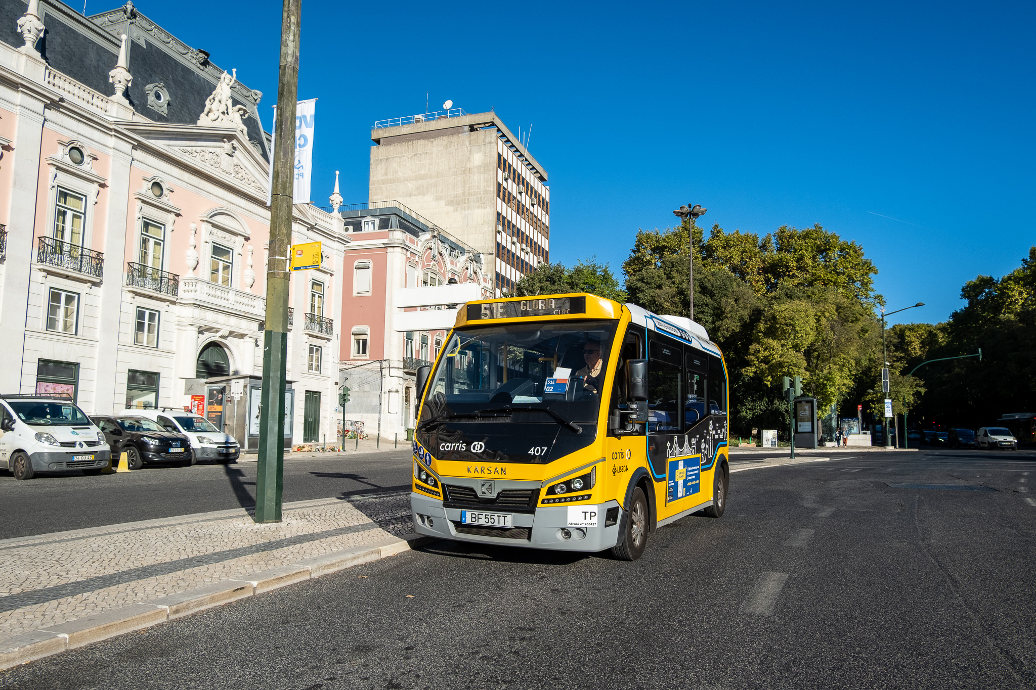
Now you can find out exactly how long it is until the bus and even see it "moving" on the map.

In a busy city like Lisbon, buses don't always manage to keep to their scheduled times. Car traffic is often heavy and blocks the buses, there is irregular parking which also causes delays here and there, and there are various other unforeseen road traffic problems which also have an impact on public transport. So, more important than the posted timetables are the real-time timetables - knowing exactly where each bus is and how long it will take to get there.
Carris already had this information and made it available to the public through its app, which is unreliable and difficult to use. But from now on, Carris' real-time timetables are also accessible on the world's most widely used navigation app, Google Maps. Now you can find out where the bus you want to take is or choose another bus that is arriving earlier and has a connection to your destination.
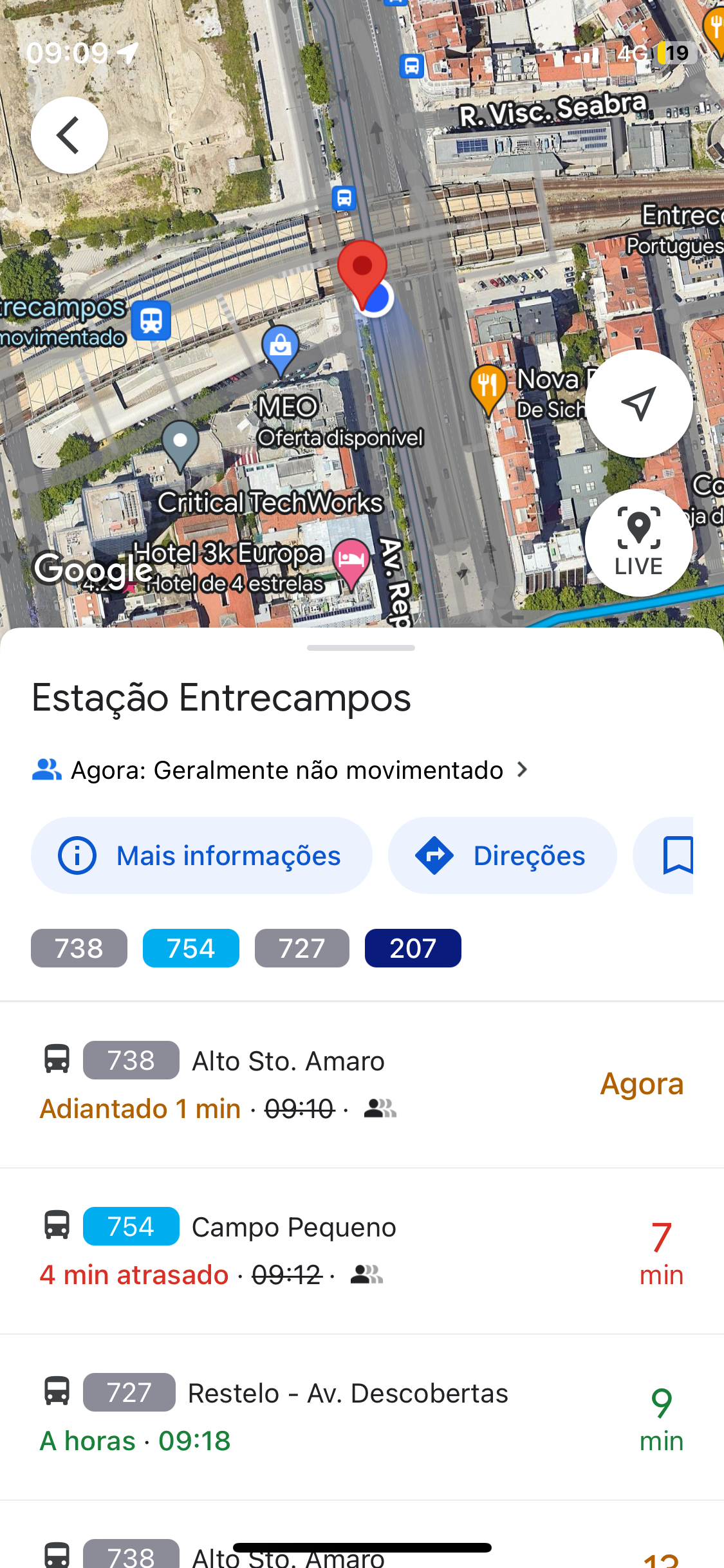
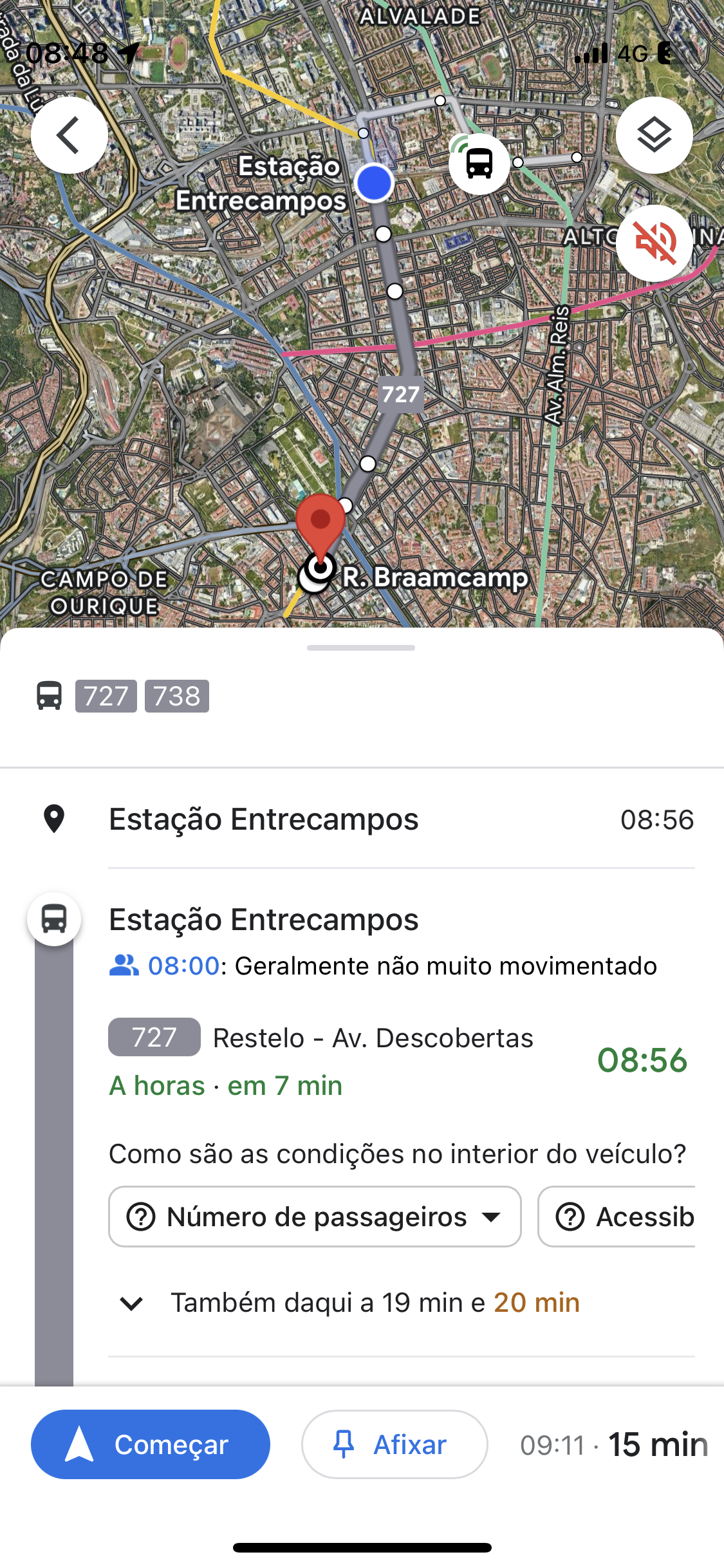
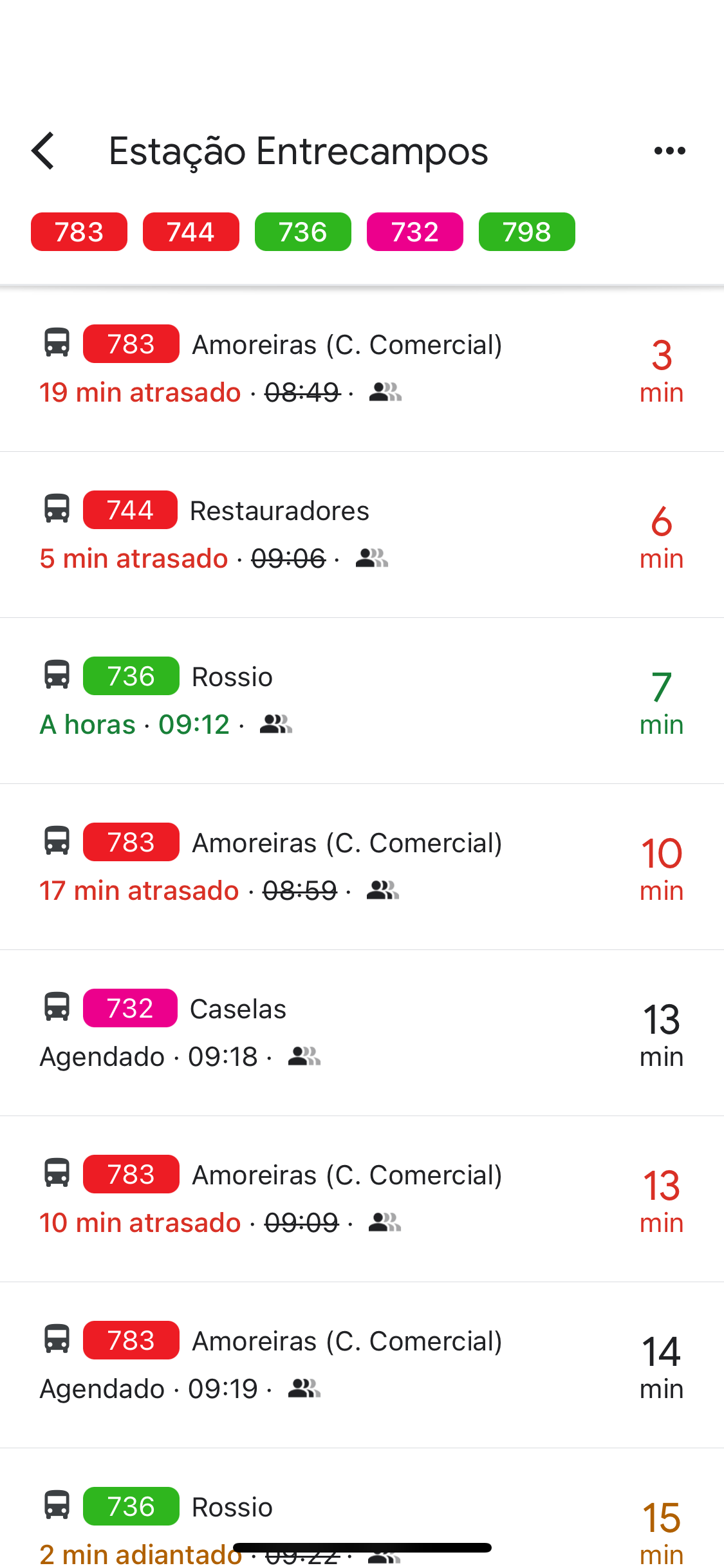
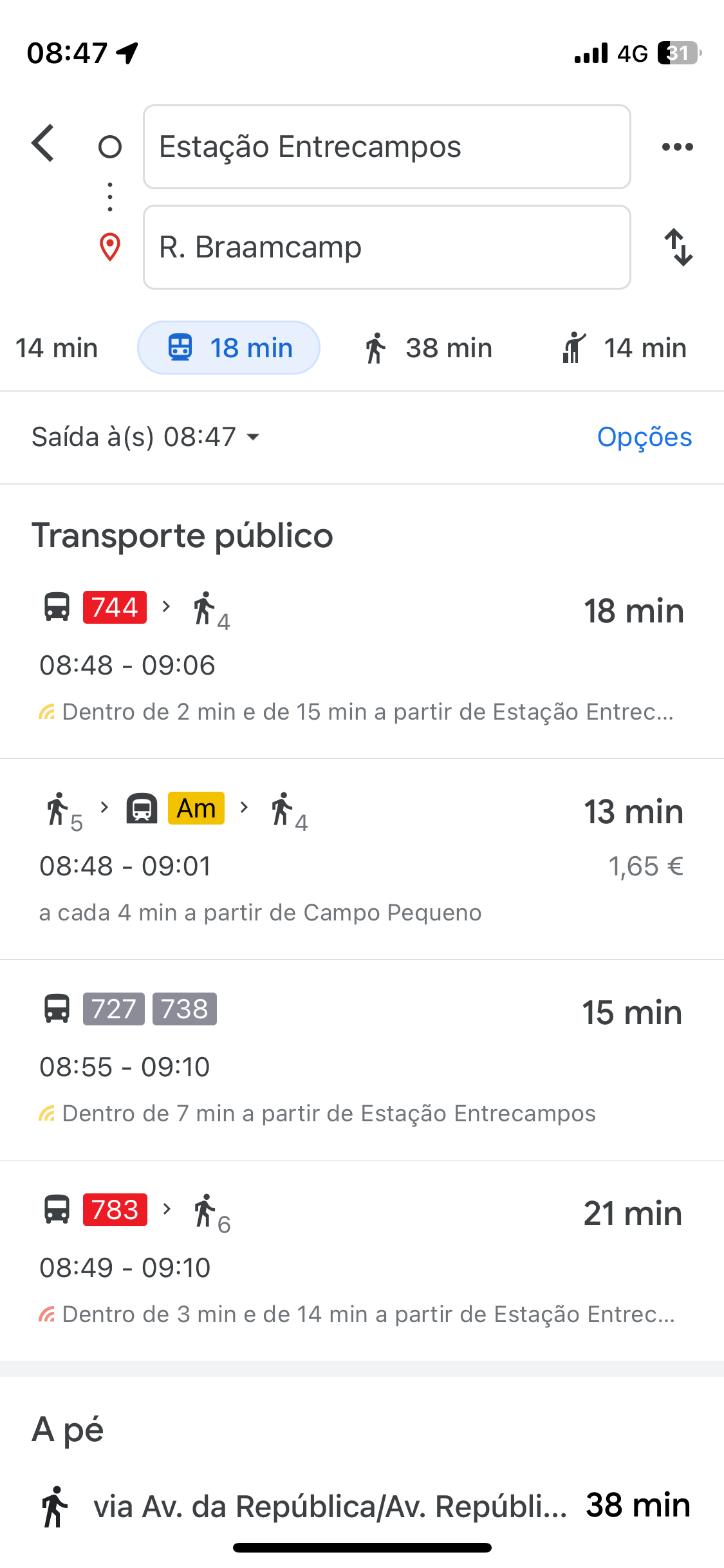
On Google Maps, just enter the place you want to go to and, if one of the travel options involves a Carris bus, you can find out the actual waiting time. Because the timetables are in real time and not tabulated, the navigation app will be able to show you the best route or suggest that you take another mode of transport, such as the metro. Alternatively, instead of searching for a destination, you can select a stop on Google Maps to see which buses will be passing that stop next, which ones are late and which ones are on time.

Little by little, public transport in the Lisbon metropolitan area is modernizing and embracing digitalization. Carris Metropolitana, for example, you now have real-time timetables on your website and on the CityMapper and Moovit apps, and will soon also be available on Google Maps and Apple Maps. MobiCascais, on the other hand, insists on having the real times only in its appThe same is true of Transportes Colectivos do Barreiro (TCB), which also has its own app and doesn't even provide route information on Google Maps (it is the only metropolitan operator in this situation).
It is hoped that Carris will also make its timetables available in real time on Apple Maps. Today, in addition to Google Maps, it is also possible to follow Carris buses and streetcars on the CityMapper and Moovit platforms. At the time of publication, Carris had not responded to these and other questions from LPP.
Real-time timetables will make a substantial difference to the lives of Carris passengers, who have been asking for this feature for a long time. However, it is also essential to "increase the commercial speed and regularity of the services provided, critical characteristics for guaranteeing the quality of the service"as Carris itself points out in its Activity Plan and Budget for 2024. "The increase in commercial speed presupposes, among other measures, the creation of reserved lanes to improve the circulation and frequency of public transport. This effort will be stepped up in the coming years in order to improve the service provided to customers."
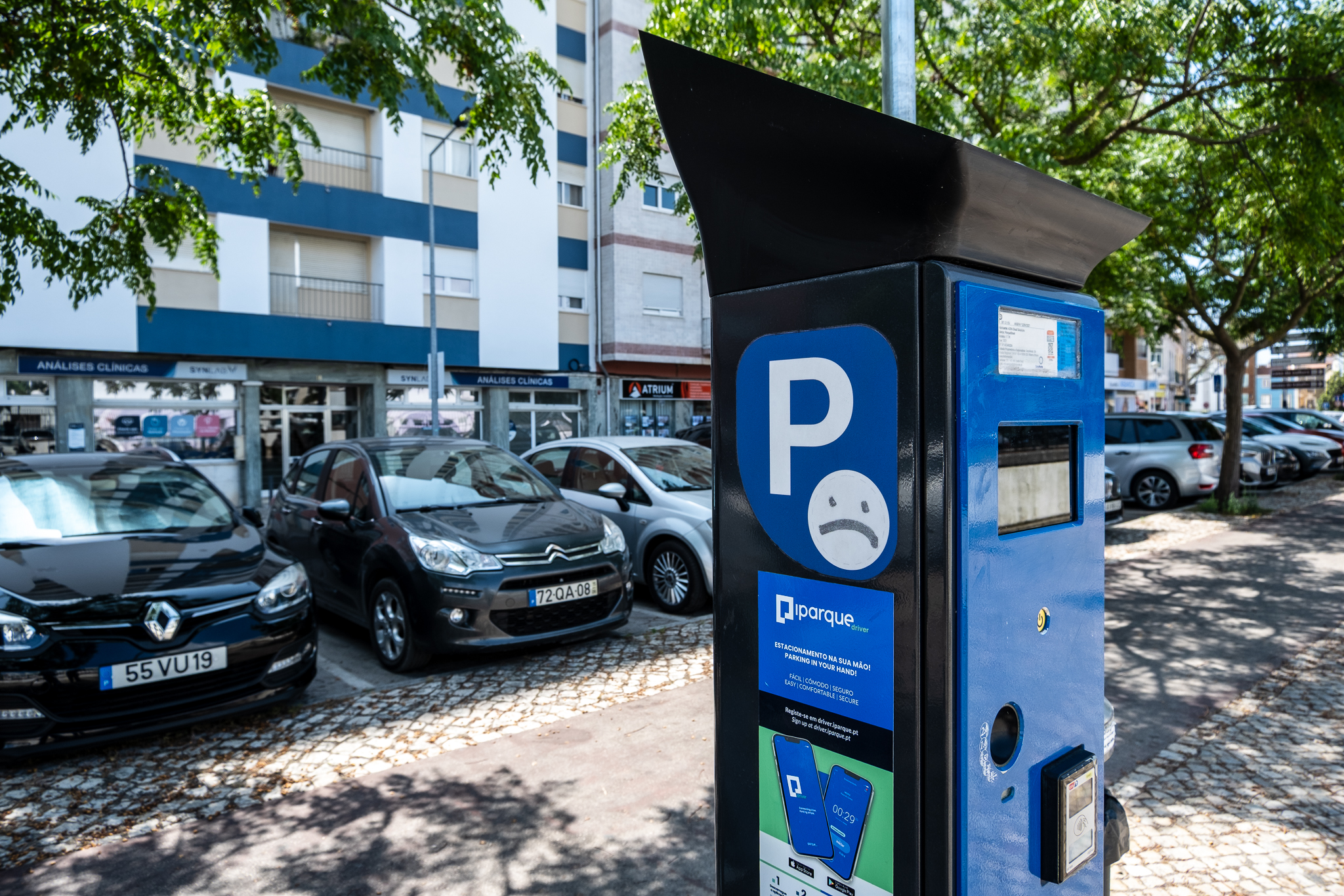
Carris also intends, together with the Municipal Police and EMEL, to step up enforcement of the use of these BUS lanes, "with the aim of mitigating the effects resulting from the undue occupation of roads, namely by undue parking, which implies the immobilization of vehicles and a reduction in commercial speed". "In fact, the improper use and occupation of the carriageways has a negative impact on compliance with the planned timetables, on the regularity of the offer and on customer satisfaction and, at the same time, on the increase in fuel consumption and maintenance costs, which must be mitigated."