From now on, if something changes on a Carris Metropolitana line, stop or regular schedule, Google Maps will let you know.

On Google Maps, all the information of the more than 800 lines, more than 12 thousand stops and the various schedules of Carris Metropolitana was already available. All service change notices are now accessible. From now on, if something changes on a Carris Metropolitana line, stop or regular schedule, Google Maps will let you know.
Since August 1, Google Maps, the most widely used travel planning application in the world, has automatically collected and made available the notices of Carris Metropolitana lines and stops. This step allows users of the app, on their mobile or cell phone, to be aware of potential constraints or changes to the route they are looking for.
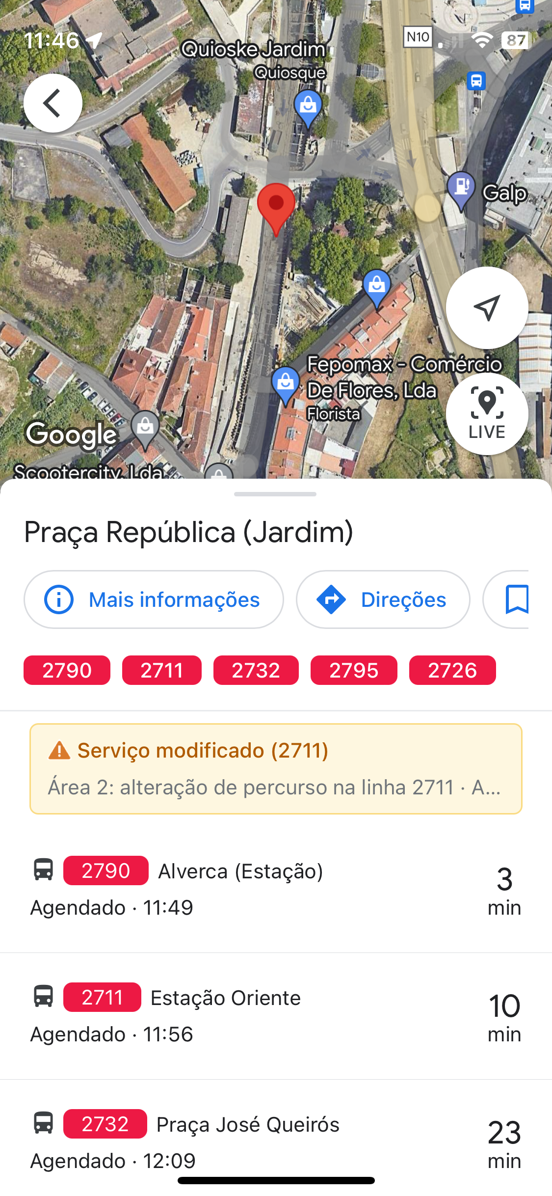
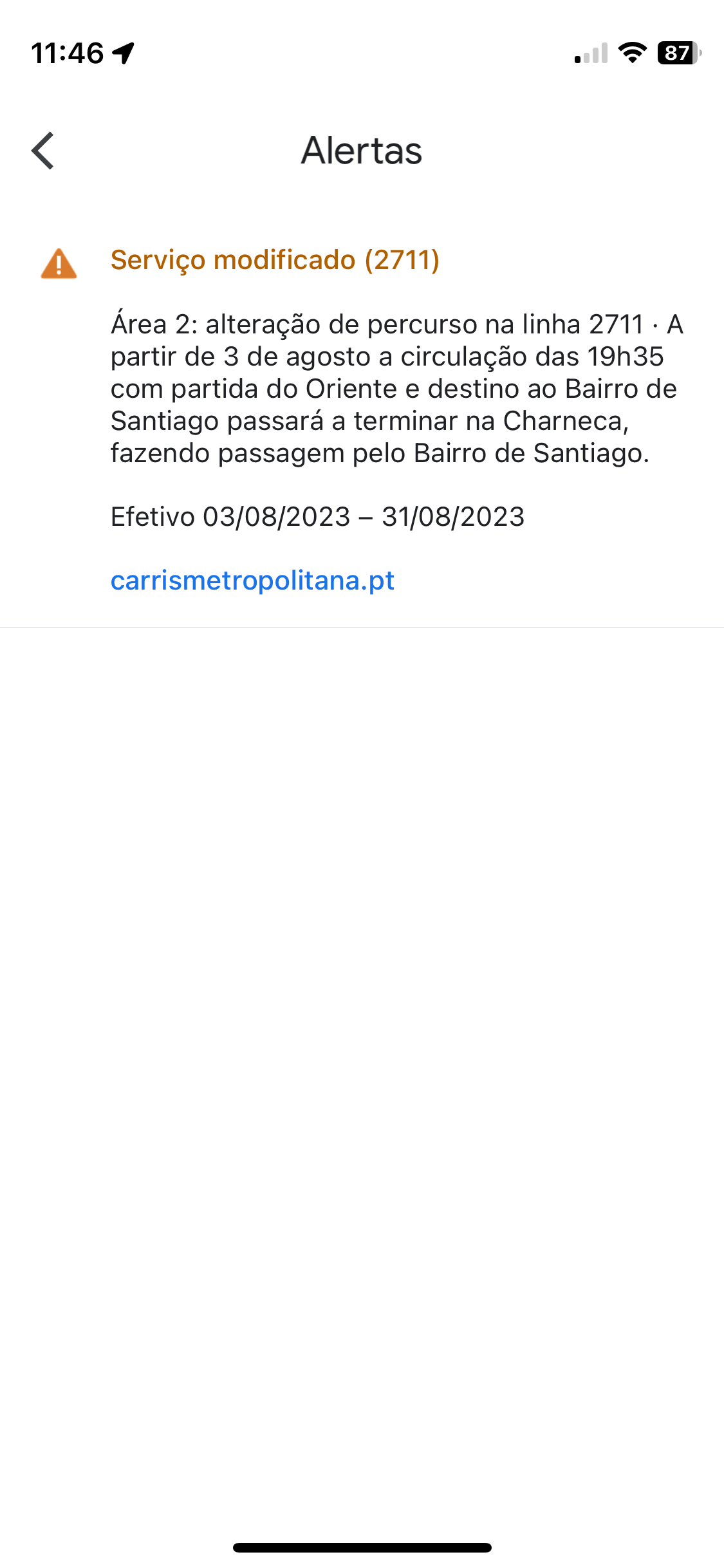
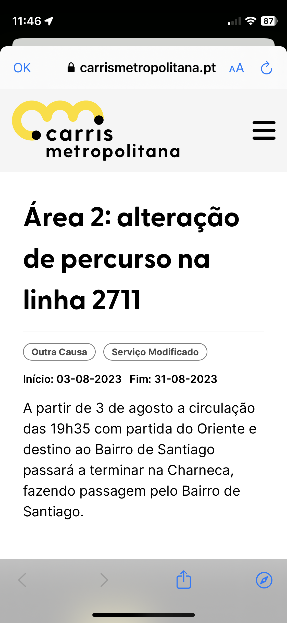
Warnings can be viewed when searching a Carris Metropolitana stop or route on Google Maps. When searching by stop, simply select the desired stop and you will find a box with the aggregated warnings, if any; by clicking on this box, you will be able to see all the warnings for each of the lines serving that stop. In the search by route, a warning box will appear whenever the selected line has some kind of change or alert associated with it; by clicking on the warning box, you can read the full text. In both cases, you will find a link to the Carris Metropolitana website where you can find some more details.

Carris Metropolitana is the only public transport operator in the Lisbon metropolitan area (amL) to automatically share service changes on Google Maps - something that saves time for the company that manages the service, Transportes Metropolitanos de Lisboa (TML), and is useful for passengers. Other amL operators put notices on Google Maps manually. For example, during the week of World Youth Day in Lisbon, Carris continued to show normal routes and timetables, with only a generic notice about the event. To find out about Carris' changes, you would need to search manually on the operator's website or see the information displayed at the stops. Carris Metropolitana, on the other hand, indicated not only the updated routes but also warnings about changed stops. However, when there are changes in routes, schedules and stops, Carris discreetly updates this information on Google Maps, using the standard GTFS (General Transit Feed Specification) format, used by these platforms - it just does not put a warning.
Carris Metropolitana's warnings were already shown in the CityMapper and Moovit apps, which also allow you to plan public transport trips in amL. In a future step, Carris Metropolitana will show in these apps the real-time timetables for your buses.
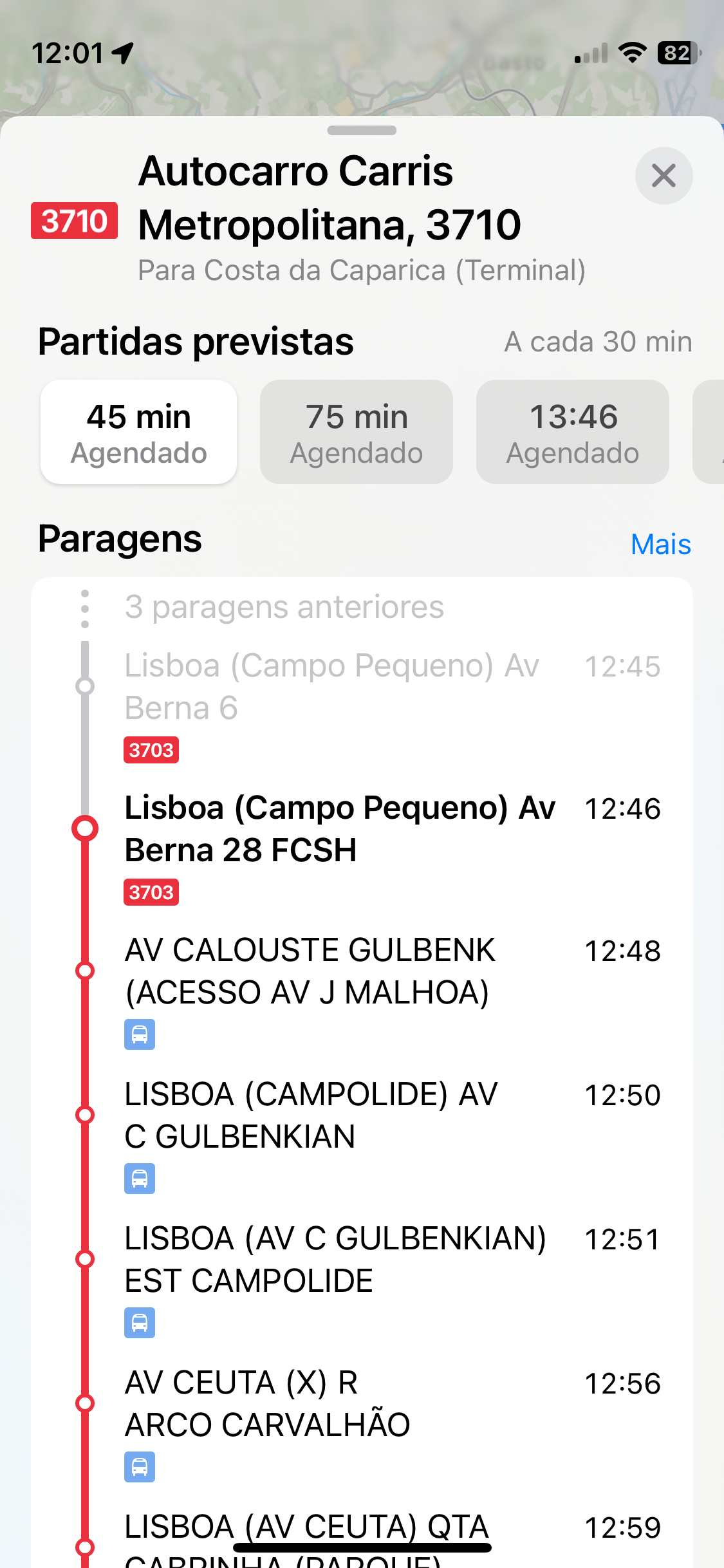
Apple Maps now has Carris Metropolitana

Carris Metropolitana's timetables and routes are now available on Apple Maps, extending the operator's presence in the most used travel planners. Apple Maps is available on all Apple devices (iPhone, Mac, Apple Watch...); and in amL, it now has information on all public transport except the Cascais (MobiCascais) and Barreiro (TCB) buses and the south of the Tagus metro (MTS).
From now on, whenever you search for a route in each of the 18 municipalities that make up the Lisbon metropolitan area in Apple's planner, all Carris Metropolitana lines that take you to your destination will appear in the range of available options.combined with the services of Carris, CP, Metro de Lisboa and TTSL.

It is recalled that, before the entry into operation of Carris Metropolitana, the information available on amL buses on digital platforms was very sparse. For example, if TST, which operated on the South Bank, made information about its service available on Google Maps, on the North Bank Vimeca and the various Barrarqueiro brands, such as Rodoviária de Lisboa, offered a huge gap to anyone searching for directions online. Carris Metropolitana has been making all the data available not only on the most used platforms, but also in an open way, through GitHub, so that anyone can, for example, develop their own application or tool.
TML, which manages Carris Metropolitana, has developed its system to be compatible with the standard format GTFS (General Transit Feed Specification) which allows platforms such as Google Maps, Apple Maps, CityMapper or Moovit to access the data and provide complete information about the service, automatically and in the same way as it is presented on the official Carris Metropolitana website.. Through the GitHub of Carris MetropolitanaIt is possible to download the GTFS file free of charge and also to use, without restrictions, the API which gives access to this data, which is always up to date.
This open data philosophy, followed by Carris Metropolitana in accordance with European guidelines, allows for the existence of a single version of all the operator's information (network, planned timetables, service alerts, infrastructure...), which is known by everyone and updated for everyone simultaneously - be it a giant like Google or Apple, a smaller platform like CityMapper or Moovit, or any app developed by any independent developer.